Sweet Alabama

We left Biloxi at sunrise, traveling the channel behind Deer Island back into the Mississippi Sound.  The channel leads from Biloxi Bay out to the Sound and Intracoastal Waterway, which runs inside the barrier islands a few miles off the coast.  Mississippi’s beaches gave way to the heavy industry near Pascagoula, and commercial barge traffic which we saw little of since New Orleans, intensified once more.  It was nothing like Louisiana, and at least here there was lots of room to maneuver.

It amazes me how long places we passed remain in view.  Looking back as we paralleled Pascagoula, I could still see the Golden Nugget Casino in Biloxi that we left two hours earlier.  That’s life at 9 mph.

Soon we approached Dauphin Island, which shelters Mobile Bay from the Gulf of Mexico.  It’s westernmost part is uninhabited, but at the Alabama State line, beach houses rise up on pilings, growing denser the further east we travelled.  The Dauphin Island Expressway bridge came into view, the play of light making its apex appear to hover over the water, unconnected to adjacent land.  Gradually the bridge filled in, though two hours remained before we would finally reach it, creeping along inside Dauphin Island. God help the Dauphinians when the next hurricane comes – and we know it will.

Passing under the bridge, we continued east while much of the other traffic veered north into Mobile Bay.  This included a commercial fishing boat which cruised aggravatingly close, on our transom for hours.  The rigging of its nets were quite different than what we’re accustomed to seeing back in Galveston Bay – looking more like a bat’s wings ready to rake the water on folding arms.  It was like a plodding marine predator chasing us at 7.5 knots.  As he left our wake, we were glad to be rid of him.

08a66780-0ed8-4d42-885d-3cad203322eb

Serene view looking up the Intracoastal Waterway near Orange Beach, AL

Crossing Mobile Bay and Bon Secour Bay took another 3 hours. Oil and gas loading platforms dot the bay; fishing boats like our tailgater friend ply these waters.  Though charts report depths of 12 feet, we followed the channel markers, enjoyed more dolphin encounters, anxious to reach the mouth of the Intracoastal at Bon Secour, near Gulf Shores.  This marks the resumption of the inland waters of the Intracoastal, and it immediately gets pretty and more interesting.  Homes line the southern bank, their docks full of water toys.  Campfire pits, Adirondack chairs, and Tiki bars anxiously await the weekend.

4943d99b-61b7-4ff5-90c6-abd709660301

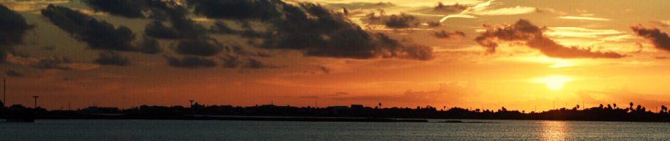
Sunset under the Bridge at the Wharf Marina  in Orange Beach

Our entry to the Intracoastal here marked the point at which we’ll “cross our wake” two years from now.  Thus, we are officially now on the Great Loop; captain and crew celebrated with pilothouse Bloody Mary’s in recognition of this significant milestone.  Our destination, The Wharf in Orange Beach, Alabama is a commercial development and entertainment complex that happens to have a nice marina.  A ten-story Condo rises up along the waterfront, and just inside of that, an outdoor mall is dressed up for Christmas, beckoning spenders.

8bd268e8-1b3e-42ec-9239-4b17dc159c9d

shops at The Wharf, decked out for Christmas

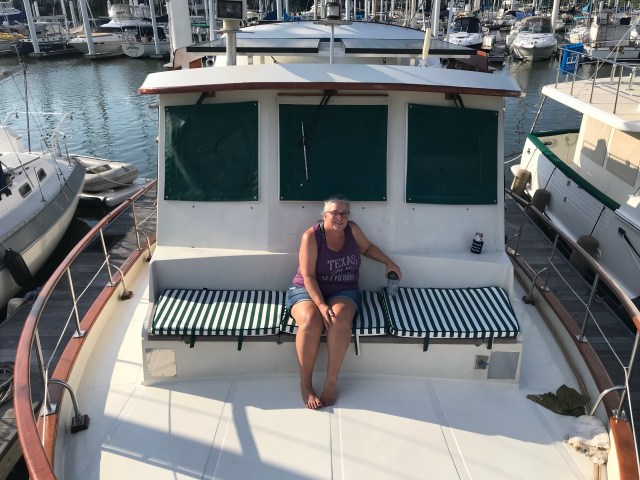
Best of all, we finally encountered other Loopers at The Wharf, some taking pause for the Holidays, and others heading for Florida.  Some started in Chicago and are two months into the journey, resting after their long trip down the swollen river systems.  One couple started in Annapolis last Spring; we met another from Oscoda, MI.  Yet another is in their final stretch, heading to their home port in Stuart FL; they know our boating friends at Sunset Bay Marina there. Most are staying for a week or longer, savoring the comforts at The Wharf while recharging personal batteries, working on their boats, and waiting for UPS shipments.  We decided to do likewise, and extended our stay from two days to a week.

d55cdf16-6c73-469b-9aad-0f871f0434d3

A freshly waxed brokerage boat reflects the setting sun just behind Cirila

As I look at our travel log, I note that as we’ve progressed, our port stays have grown longer.  Sometimes I’ve felt guilty about this.  After talking to fellow captains, I’ve discovered a common theme among us is that we are tired upon reaching destination – mentally drained.  Docking or anchoring at dusk then leaving the next day does not allow enough time for the weather study, tidal analysis and route planning necessary for safely cruising subsequent legs.  Leaving two days later might allow for enough planning, but little extra to recoup, or enjoy where we are at the moment.  We started to learn this lesson in Mississippi.  It’s being reinforced in Alabama.

7988da9f-4c84-400f-8d4e-390dfb62326a

Morning fog beginning to lift at The Wharf.  This time of year, fog can hinder our inland travel

From here, the Florida panhandle awaits, and beyond it, “The Crossing”.  This passage stresses Loopers perhaps more than anywhere else along the 6000 mile journey.  It demands either a 22 hour cruise, 40 miles offshore at night, or alternately, three eight hour “rim route” jumps through the shallow waters closer to the coast. The comfort and safety of this leg, regardless of route, are all about the weather.

The small towns of Apalachicola and Carrabelle are jump off points for this cruise south.  Cruisers awaiting a good weather window can stack up in these small ports, as they are now.  Thus, as we enjoy Alabama, we are plotting the Florida panhandle, laying out the four legs and stops between here and Carrabelle to coincide with favorable crossing conditions.  It’s all about the weather.

With Louisiana behind us, it is the Passage that rattles my nerves now.  I contemplate sailors 500 years ago, doing this passage with a compass, sextant, and a leaky boat manned by drunken misfits.  I suppose that’s why there are shipwrecks noted on our charts.


Posted in Places | 1 Comment

Mississippi

We left Seabrook Marina in NOLA at sunrise, pointing our bow north into Lake Pontchartrain.  As usual, our timing was weather driven, as we tried to tuck in behind a weak squall line moving east ahead of us. We were just a bit early, catching the southern edge of the front as we approached the railroad bridge at the east end of the lake.  Wind and rain increased in concert with crab pot density, stressing the crew – then the center windshield wiper quit!

Thankfully, the rain and crab pots let up as we turned eastward toward “The Rigolets” (rhymes with cheese, if you can believe it), which connects Pontchartrain with Lake Borgne and the Mississippi Sound beyond. Before exiting The Rigolets, we circled for thirty minutes waiting for a railroad bridge opening. The swing bridge operator needed winds to calm and an oncoming train to pass before opening.  He finally radioed, stating he’d open it partially and that we could squeeze through ahead of the train.  We revved up the engine and pushed through the narrow gap as currents pushed us about, breathing big sighs of relief as we emerged in Lake Borgne.

The remainder of our cruise to Bay St. Louis was less eventful.  Though much of the next couple hours were in 2-4′ seas, we were taking most on the bow, which Cirila handles well.  Along the way, we passed the mouth of the Pearl River, marking the Louisiana – Mississippi border, and the spot where Hurricane Katrina made landfall in 2005.  The coast there and in the nearby town of Waveland were hit with a 28′ storm surge!

d01c9429-0552-48c0-97ab-7266a7edcebb

One of three Railroad Swing bridges we passed between Seabrook Marina and Bay St. Louis.  The one exiting The Rigolets was only partially open, requiring a harrowing squeeze through. 

The town of Bay St. Louis (BSL) sits just north on a piece of high ground at the west side of the the Bay, and Pass Christian on lower ground on the east side.  Katrina decimated both towns.  As we approached the bay, we watched charts closely to avoid spoils where broken bridges and concrete were dumped in the aftermath of Katrina.  We transited one final swing bridge before easing along the transient bulkhead at the BSL Municipal Marina.  The new marina and waterfront park were completed 3 years ago – by far the nicest stop of our journey thus far.  Yacht owners from New Orleans and beyond keep vessels here, not only because cruising grounds in Mississippi Sound are so accessible, but because the town is delightful.  There are no traffic lights, a thriving and eclectic artisan community, and good restaurants which locals frequent via golf cart.

The Blind Tiger (TBT’s) is a restaurant / bar closest to the marina, and was a welcome spot to unwind after our long journey and enjoy dinner off the boat. The smoked tuna spread appetizer was delicious, the Royal Red jumbo shrimp even better.  Beers around one of TBT’s campfire pits topped off a great evening.

2ca453ad-74ca-40c3-ace9-514d16ef8a37

The captain like the TBT story.  There are four of these along the Gulf Coast

While tied alongside the entertainment dock, numerous residents stopped by Cirila, curious about our travels.  A gentleman named Patrick stopped a couple times during our brief stay.  Originally from Livonia, MI and now living in Dallas, he shared an interesting perspective.  Searching for a second home getaway reachable from Dallas, his family looked hard at Port Aransas, TX, near Corpus Christi.  Not happy with the amenities there, they discovered Bay St. Louis, MS was equidistant, visited and fell in love.  They now own a second home in BSL, as well as a rental property they host on AirBnB.  After spending a couple days there, we understand why.

bae3c6f1-00ca-4b9e-b5bd-00fc5a5a617c

The peaceful and well located Bay St. Louis Municipal Marina. A must stop if traveling east from New Orleans 

The Mississippi Sound borders this stretch of the gulf coast, between Bay St. Louis and Mobile, AL, separated from the Gulf of Mexico by a string of barrier islands a few miles offshore.  There are nice beaches along the coast here, sometimes known as “The Redneck Riviera”.  As we saw coming into BSL, winds can kick up quite a chop in these relatively shallow waters, so we waited for a good weather window before taking our short, four hour leg east to Biloxi, MS.  We enjoyed a beautiful cruising day, joined four different times by pods of dolphins, swimming alongside and playing in our bow wave.

We tucked in at the Point Cadet Marina in Biloxi, directly behind the Golden Nugget Hotel and Casino.  Point Cadet seems a more popular hub for fishing charters than home to pleasure craft, and though the facilities and staff are nice, it is not a very walkable location (unless you like strolling about casinos). Had it not been for 30 knot winds, we would have departed for Alabama sooner.  High winds and chop in the marina made for two nights of shallow sleep, as it was difficult to get Cirila tied as securely as we like.  One of our new dock lines almost chaffed clean through the first night, and another bow line we set was at an awkward angle, strained and creaking all night long, only marginally helping keep the bow centered in the slip.

c8d31a6f-0a7d-4908-a40e-d7d60965b800

Cirila tucked in behind The Golden Nugget Casino in Biloxi.  We were rocked by 30 knot winds for two sites, but the wifi was the best so far.  

Our next leg traverses more of the Mississippi Sound, running just inside Dauphin Island and across Mobile Bay to Orange Beach, Alabama.  Since this is where we plan to cross our wake in a couple years, we will have officially begun our Great Loop along this leg.


Posted in Places | Tagged , , , | 3 Comments

Lousiana #4 – The Big Easy

We left Houma just before sunrise on Saturday for the challenging leg through New Orleans.  Thoughts of this leg frayed our nerves before we even left Houston – especially Dawn’s, since she was our designated line handler through the locks.  It was a dreary morning, with a steady, light rain that finally began to lift about halfway to New Orleans.

The GIWW twists its way through more oil country along Lake Salvadore, then past the small town of Jean Lafitte.  The privateer’s legacy is spread across the entirety of the trip between Galveston and New Orleans.  DNA tests of the local populace would provide even more interesting data.  The little town is an airboat hub for New Orleans tourists.  What follows is an interesting meander through Crown Point, the first residential, “no wake” stretch we’ve seen.  Residents own small fishing and shrimping boats, many resting on their bottoms in broken down slips, water lapping through the open holes where windows used to be.

A turn north by the Boomtown Casino, points us up the final stretch of the GIWW before reaching mile 0, at the Harvey Lock.  The narrow waterway is lined with tugs and small shipyards.  Barges are scarce, because Harvey was built in 1909, when they were hauling small barges of cotton and rice instead of monster “6 packs” of benzene and ammonia.  Tug traffic too is minimal, because it is Saturday.  This helped immensely, as it was far easier and faster to coordinate bridge openings in the Harvey Canal, and get into the lock with a minimal wait.

The lockmaster on VHF 13 told us to enter the lock and tie up alongside a small tug at the front of the lock.  The deck hand, himself in training, took our lines and secured us a alongside while a big tug nestled in behind us, his bridge towering 4 stories above our aft cockpit.  The west gates closed and the chamber began to fill, taking about 10 minutes to equalize with the Mississippi river above.

fb6ffba1-e3bc-44f2-adb7-110978279c8f

Looking up to the Captain of Miss Aileene, the tug we rafted to in the Harvey Lock.  Once through, they led the way to the entrance to the Industrial Lock, making sure we didn’t miss it.

The gates open and we are first out, so that we are not caught in turbulence caused be the tug’s powerful thrusters.  We are, however, captured by the powerful current of the Big Muddy.  Its like a one mile wide, 100′ deep storm sewer draining half the country.  In front of downtown New Orleans, waves roll in all directions, as ocean freighter driven wakes reflect off sea walls protecting the city.  Passing Jackson Square, one of the forward seat cushions that Dawn made lifted from the bench, going airborne past the pilothouse window, and into the churning water.  We let it go rather than trying to retrieve it in the churning water.

afb4712d-fd42-45d2-8f82-d538f3fe52a1

Downtown New Orleans as seen from the middle of the Mississippi River, with the Superdome peaking up on the left.


About 4 miles downstream of Harvey, past the French quarter on the eastern bank, is the entrance to the Industrial Lock.  We had to wait for about 30 minutes, as the lock tender struggled to open a railroad bridge at the entrance to the lock.  We joined two oyster boats and a demasted sailboat in the chamber, this time lashed to the port wall. We were lowered 6′ into the Industrial Canal, marking the beginning of the eastern portion of the ICW.

A few more miles and bridge openings brought us to our destination – The Seabrook Marina and Shipyard, just south of Lake Pontchartrain.  We pulled into our slip at 3:30, meaning that the two locks and 5 bridge openings added less than two hours to our projected travel time.  Transiting this stretch can sometimes take 6 hours or more as tug traffic, bridge curfews, and lock breakdowns corrupt best laid plans.  We had done it!

a7b4d120-22b9-4755-8f21-1c7726528280

After the Industrial Lock, just a few more bridges separate us Seabrook Marina with Lake Ponchartrain beyond.  The water was markedly cleaner on this side of the lock.

As we maneuvered into Slip 10 at Seabrook, our bow thruster shrieked and stopped thrusting.  We were able to secure Cirila without it, so did not let the lost thruster delay our tradition of cracking of a beer after shutting down the engine.  Soon after, came the demasted sailboat, Scout.  Aaron and Shawna just brought it from Tulsa, down the Arkansas river and Lower Mississippi.  Its hard to fathom just how miserable that trip must have been.  Scout looked like Jed Clampett’s boat, the deck a jumbled mess of dock line, anchor rode, rigging, jerry cans, and bulging trash bags.  Shawna drove back to Oklahoma for work, leaving Aaron to clean up Scout, re-step the mast at Seabrook, and ready her for their planned cruise to the Caribbean.

img_1596

Seabrook Marina, our home for 4 nights along the Industrial Canal in New Orleans.

Because it was also a shipyard with haul-out capabilities, Seabrook could not have been a better place to break down.  We would, however, have to wait until Monday to talk to the service department, so we settle in. Winds kicked up Saturday night.  Because the docks project into the canal, hours of rocking and bumping into the pier did not allow for a good sleep, despite our exhaustion.  The weather calmed Sunday, and so did we, enjoying a day of football and needed rest.  We even took the bikes out to go explore, but unfortunately, there was very little to see from the saddle in this part of New Orleans.

We maneuvered to the boat lift early Monday for a quick haul-out so we could inspect the thruster.  As suspected, the zinc on one of the the thruster props had come loose.  The ensuing vibration caused the coupling which connects the thruster motor to its gearbox to disengage.  We fixed the zinc easily, but would need to wait until Tuesday morning for a coupling to be delivered, spending the night floating, but cradled in the slings of the boat lift.  At least it was calmer than being on the canal!  The coupling arrived Tuesday morning, took longer to replace than expected, but was back on line by noon, but high winds forced us to stay another night.

We used the afternoon to take Seabrook’s loaner truck, with no wheel bearings and 1/2 a suspension, to a West Marine hoping (with no avail) to replace some of the spares we had used.  Striking out there, we walked to Three B’s Burger and Wine Bar for lunch. It was in a quaint commercial district called Lakeview; The burgers were delicious and the cacophony of other people was music to our ears.  Finally, we reprovisioned at a Rouse’s market, the official grocery store of the Saints, like HEB is for the Texan’s.  We liked HEB better.

We were back in Slip 10 for one more night, watching the weather and preparing Cirila for our next leg.  This one would take us behind a moving front line into the shallow, open waters of Lake Pontchartrain, through the Rigolets, and a corner of Mississippi Sound bound for Bay Saint Louis.  We made the boat ready for rougher conditions.


Posted in Great Loop Milestones, Places | Tagged , , , , | Leave a comment

Deep Louisiana (#3)

Louisiana is most unique among states.  Alaska probably comes close, but I’ve not been there yet, so it doesn’t count.  Cajun, Creole, and Coon-ass all belong to Louisiana – nowhere else.  Red beans & rice, boudin, and gumbo belong to Louisiana. No city in the US approximates New Orleans.  No local dialect is so distinct that to an untrained ear, it sounds like a foreign language.  And no state has a costal boundary as ambiguous as Louisiana’s.

South Louisiana doesn’t really have a coast. You can’t define it by a beach front, barrier islands, or a coastal road.  Much of it you can only see by plane or boat. If you must hide, take a duck boat to south Louisiana – you won’t be found, and absent a guide, probably won’t find your way out either.  It is a tortured maze of rivers, lakes, canals, salt marshes, and bayous.

Approaching Intracoastal City, entering the Leland Bowman lock at sunset, then “Floating the Middle”. This lock doesn’t control water levels, but tidal intrusion of saltwater into rice farms further inland.

The oil & gas industry permeates south Louisiana. Towns exist anywhere dry ground shares deep water access to the Gulf, and they all exist to serve the oil and gas industry. The waterways of Intracoastal City, Berwick, Morgan City, and Houma are long expanses of shipbuilders, scrapyards and industrial docks.  Dilapidated piers, abandoned warehouses, and rotting hulls share the banks, monuments to business write-offs and escaped liabilities.

A casino barge is slowly dismantled for scrap

Seeing it from the water offers an inverse perspective, like taking Amtrak into Philadelphia. You see the underbelly, the unvarnished character of places along the way. No signs congratulate the 2006 state softball champs. Though there is much beauty to absorb, none is man made.  Architects and artisans worked elsewhere.

For a stretch, the GIWW winds around large salt domes, revealed by topographic “bumps” on the surface. Places like Weeks, Cote Blanche, and Avery offer high ground in an otherwise flat, marshy expanse.  The waters around them are dense with canals dredged decades ago so that drilling rigs, production equipment, pipelines, and workers could access the fossil riches beneath.

A Bald Eagle delivers fresh redfish to its mate on the way to Morgan City

Our stops through South Louisiana included Intracoastal city, Morgan City, and Houma, not because of their tourist value, but because there are so few options to tie up or drop an anchor for a good night sleep. First came the Shell Morgan Landing fuel dock in Intracoastal City.  Soon after transiting the Leland Bowman lock. we were happy to tie to the bulkhead just as dusk settled in. A month after Katrina struck in 2005, this and other small bayou towns were devastated by Hurricane Rita.  A three wood away,  rebuilt on 16′ stilts, stands Maxie’s Grocery – a well stocked little store that made the most  delicious, fluffy breakfast biscuits.

img_0149

Cirila in early morning light at Shell Morgan Landing, a spot also favored by mosquitos. 

Next was Morgan City and an inexpensive but popular municipal dock on the Lower Atchafalaya. The Atchafalaya takes the flow burden off the Mississippi and is probably the biggest river non-cajuns have never heard of.  It took so much burden this past spring that the bulkhead type dock was shoaled in. We approached twice before backing out, finally going across the river to tie up in Berwick, with much deeper but far faster water under the keel.  It was a welcome overnight where we enjoyed shallow sleep.

84e17f39-cbd3-4f29-b734-b42a73383595

Tied up at the Berwick City Dock.  Morgan City is over the bridge, across the Atchafalaya

Because our next destination of Houma was only five hours away, we were waking slowly, making coffee, and enjoying a leisurely departure. While enjoying my coffee, I called the Bayou Boeuf lock, 15 minutes east on the GIWW.  They advised that we must be there in 30 minutes to lock through – afterwards, locks would close for the day.  We had a 5 alarm fire drill aboard Cirila, but made it through that morning. Once we settled down, coffee at our fingertips, we enjoyed a leisurely cruise in beautiful stretches that wound between the salt domes.

Leaving eastbound from Morgan City, dense industryd3ee6066-f76a-48da-ac57-39ba98d9994c suddenly yields to what is probably the prettiest stretch of GIWW in Louisiana – a meander through Black Bayou. Huge cypress trees laden with Spanish moss line the banks.  We expected to see alligators prowling, but didn’t.  In fact, we saw more bald eagles than alligators in Louisiana.  Most unexpected!

Approaching Houma, commercial traffic increased again, but the tugs were smaller. As the GIWW winds through the town of Houma. it could only accommodate single wide barges; the radio was busy with captains positioning their boats for passes in the narrow channel.  The Houma City Dock was just off this narrow section, nestled in a canal between a pair of bridges carrying highway 182 over the GIWW.  Houma was a peaceful spot, and needing the rest, we decided to stay an extra night. That night, we celebrated our 1 week anniversary on the water, with a great dinner at Christiano’s, our first meal off the boat since Stingaree. Then the following day, the boat “Just Jillin” pulled in behind us, on their way back to Beaumont after completing the Great Look a couple weeks earlier.

The first night, we had our soundest sleep since that first night at Bowtie.  Our second night was burdened by nerves for the following day – transiting the Harvey Lock into the Mississippi, past New Orleans, and back down through the Industrial Lock.

8532590e-a889-4dd2-a498-6bedf21cd47f

Off the cockpit in Houma, before Just Jillin pushed the water hyacinth out of the way


Posted in Places | Tagged , , , , | Leave a comment

Calcasieu, or Louisiana 2

The Calcasieu would be our first encounter with locks.  Along the GIWW, the locks are made to fit the large barges creeping all over the gulf coast. This one is almost 1/4 mile long.  They serve more to control saltwater intrusion and flooding than they do changing elevation between waterways. The lock chamber is lined with timbers, which the barges destroy over time.  They’ve been repairing Calcasieu for two years, and to accelerate progress, they close the lock for daytime repairs.  Since there’s nowhere to stop on the east side of the lock, we needed to be ready to lock through at 6:00 am, leaving ourselves time to travel afterwards.

Thus, we left comfortable Bowtie Marina, navigated out Contraband Bayou in blackness, then chugged down Lake Charles and the Calcasieu river, at night.  We followed our “breadcrumbs” (the trail left on our charter plotter) from our prior trip going in the opposite direction.  This helped immensely.  Once we arrived near the west side of the lock, we had to wait for them to clear four barges traveling west, bobbing around and holding station for two hours. We were first in an eastbound procession until time for closure.

Floating the Middle of the Calcasieu lock at a little before 9:00. This was a milestone achievement.

Locking was not as scary as we thought.  At least not this one.  We were instructed to “Float the Middle”, which just means no tying up.  As the west gate closed, we floated and crept eastward. As we got there, the east gates opened and off we went.  The water as we exited was a mess of floating marsh grass, torn up by tows pushing their barges into the banks while waiting their turn to lock through.  Thrust vectors from the tugs created cross currents and eddies far into the channel, knocking our bow 15 degrees off our heading. We got used to it, learning to adjust our course early. We saw barges lined like this for 5 miles east of Calcasieu.

Because of the early start, we decided to press all the way to Intracoastal City, where we would tie up for the night at Shell Morgan Landing. It was a beautiful, long day. The heavy commercial traffic finally eased. We travelled for hours and did not see a soul.

Maybe this is where the transmission finally failed. Many a vehicle has been abandoned along the banks.

Channels interlace much of GIWW and bayous, with small well heads dotting the marshes, sometimes one to an acre. It’s ironic and sad that the Louisiana Coast will be an early victim of the climate change its exploitation has helped cause. Most of the Gulf Coast, from Corpus Christi to New Orleans, is dedicated to oil – it’s exploration, production, transport, and downstream conversion – into everything from jet fuel to antifreeze, and from detergent to every plastic known to man. So much is at sea level. Today’s sea level. Most of my career has been in its support.

Places to stop for the night are few, and separated by hours of travel when pummeling along at 7 knots. Voyaging at its best is a finely choreographed affair, combining good docking or anchoring locations with weather forecasts, tides, lunar and solar phases, at departure time, en route, and at the expected time of arrival. It’s gratifying when the pieces fall in place and you arrive in perfect conditions just after sunset. That’s what we did at Shell Morgan Landing.

Shell Morgan Landing before leaving for a Morgan City at 7:00. It’s a perfect overnight if your willing to splurge $25 for a good nights sleep. Maxie Pierce Grocery, about 300 yards away, is a great provisioning spot and makes the best fresh breakfast Biscuits.

Posted in Places | Tagged , , , | Leave a comment

Louisiana 1

Just as we dropped anchor in the lovely Shell Island anchorage, we lost all DC power on the boat. Some may have solved this in 10 minutes; for me, it was a couple hours. Root causes are nice to know, but getting our DC circuits on line was more important. We got them fixed and could relax aboard as the sun set over Shell Island. Like the missing electrical root cause, I still can’t explain the phantom, rainbow sunset on the left.

Shell Island is a beautiful anchorage in a 12’ deep oxbow lagoon just off the ICW. If only the crabbers would put more space between pots so boaters can swing at anchor without tangling in one.

Dawn did not sleep well that night, worrying about anchor swing while feeling the reverb of nearby tow boats, even though they passed on the other side of the marsh. Thoughts of how to avoid blowing our last 125 amp DC fuse while pulling up 120 feet of 5/8″ anchor chain hampered my sleep.

In the morning, I accomplished the latter by hardwiring the windlass to the hot side of the fuse block. It worked. We idled out of Shell Island and into the ICW, eastbound for Lake Charles. There are beautiful stretches of ICW here, where it looked less like a ditch, and more like a meandering river. We saw our first alligator and used our Audobon guide to identify birds. We also changed the game plan so we could find replacement fuses and allow time to make a couple other minor but necessary repairs.

We secured a slip at the Bowtie Marina in Lake Charles – one of their two. It’s hidden deep in Contraband Bayou, which winds behind the Golden Nugget and L’Auberge casinos. Doug Shearman and his wife run it; it was the perfect stop and they are wonderful people.

Being so safe & close to the Coasties also meant utmost discretion when peeing off the boat at night. This risk despite Bowtie having the only public pump out for 50 miles.

The Lake Charles Coast Guard Station ran patrol boats off a pier next to ours. We watched them do pre-checks before patrols, train junior cadets, and smoke and laugh around the picnic table behind the station. I was most moved watching the ritual of lowering the base colors at dusk, thinking proudly of my niece Maddie, who serves in the Army.

All that, but the coolest thing about Bowtie and Contraband Bayou is that Jean LaFitte used to hide here. Like Galveston, Lake Charles was in his main sphere of influence. Contraband Bayou has an both an entrance and exit into Lake Charles, so there was a means of escape. It’s deep, narrow, twists, turns, and its dark. We draft 4.5′, have two sonar transponders, two chartplotters, and I was nervous creeping in there. Jean came in under sail, drafting 10′.

Back in Contaband Bayou, where Jean LaFitte hid and is rumored to have buried a few things

We spent two nights at Bowtie, sleeping like hibernating bears the first night and nervous squirrels the second. Second night jitters were because the next morning, we planned to wake at 3:45 am, leave the dock in darkness, navigate out the bayou and into Lake Charles, for a predawn, 90 minute cruise down the Calcasieu River, just so we could arrive at the locks at dawn.

Jean LaFitt’s treasure may lie near this little fishing dock on Contraband Bayou. (Wink to my sister)

T

Posted in Places | Tagged , , , | Leave a comment

The Journey Begins

Somewhere in the ether is a draft posting, which tried to capture the activity and emotions of the last few days before our departure.  Those days were so stressful that I probably deleted the post accidentally.  There were multiple trips to West Marine, and contractors finished our ice maker trim work the day we left.  We relished last gatherings with friends at Watergate, Waterford, dinners with the Kelly’s, the Leichliters, and Hans and Paula and the crew at Sundance.  I don’t mind that I lost the draft – I’d had enough about posting the “preface” and was ready for the real thing.  And this is it, because we’re underway now.

Our Great Loop started at 11:00 on Wednesday, November 13, 2019, four years to the day after we bought Cirila.  The day promised a short break in the cold front, but it was still 50 ‘s and gray.  What mattered is that the wind settled, so waters would be smooth.  We added 200 gallons of fuel in Kemah before entering Galveston Bay for our trek to Bolivar.

Our first leg took us past Redfish Island, then on a 3 hour jaunt down the Houston Ship Channel, sharing sea lanes with ocean going freighters and tow barges carrying mankind’s most explosive creations and known carcinogens.  Redfish, incidentally, is the closest cruising destination for Houston area boaters.  Kelly McGuire, Houston’s Jimmy Buffet, has several songs about it, and even plays a concert there.  We look forward to finding more interesting places.

b179860c-5c58-47e6-962a-d462b0354fed

Redfish Island is the thin spit of shells and gravel in the foreground.  At one time, it is said that Tillman Fertitta’s ancestors ran casinos and brothels there, before a great hurricane reduced it to this.  The photo makes everything look cold and gray because it was.

Galveston Bay was smooth to Bolivar Roads, but commercial traffic was unusually heavy.  Bolivar Roads is the intersection of the Intracoastal Waterway and the Houston Ship Channel.  It’s like a Walmart parking lot on Black Friday except with barges and freighters, sailboats and fishing skiffs.  We’ve been through it many times before, but have always turned right, or westbound, into the ICW.  On this day, we made our first left turn into the ICW, entering new waters for us.

a5639d61-c6f9-4ebc-934f-8a81def65450

The first few miles of the ICW eastbound is a melee of commercial traffic, with fleets of shrimpers, crew boats, and shipyards servicing the the offshore oil industry

Our first planned stop was not far east into the ICW, at a new residential development called Laguna Harbor.  Our cruising guides reference it, and the Harbormaster assured on the phone that they had adequate depth for our 4.5′ draft.  Stopping here set us up nicely for the much longer second leg, a planned nine hour run to an anchorage called Shell Island.

We stopped there alright – as we began to run aground entering the harbor.  I was able to back off before getting stuck, but turning to re-enter the ICW, we ran aground again.  This time I couldn’t get off.  Rising tides are the friend of grounded boats, and so it was with Cirila.  About 6″ of tide and the wake of a passing fisherman gave us a brief window to power off the shoal, which we did, but with nerves rattled and confidence shaken.

Our fallback plan for Laguna Harbor was a stop further east along the ICW, at either Steve’s Landing, or Stingaree Marina and Restaurant, so we pushed onward.  About an hour later we approached Steve’s – a place pelicans and kayaks might be able to land, but not us.  We called Stingaree – about 30 minutes further on, and they gave us instruction on how to approach and where to dock in about 5′ of water.

Dusk descended as we approached Stingaree, and we were frazzled because we didn’t have a fourth alternative in the plan.  Landmarks fit the description, and we tried to ease around a pretty Fischer Motorsailor to the bulkhead.  There was no one ashore to help land us, and I came in hot, but we made it.  We secured the boat, walked Lola, and headed to the restaurant for a much needed drink(s) and dinner.

1d795eba-b069-49b8-b914-7bb7b7b92292

The Stingaree Restaurant and Marina was home for 3 nights.  The restaurant is outstanding; the marina best for smaller boats. We sat on the bottom at low tide, but floated out on high tide Saturday morning.

The engine temp ran about 15 degrees hotter after our grounding, suggesting that our raw water strainer had taken on some debris, so the first order of business the following morning was to clean the strainer.  It was an older strainer, kind of a stupid in design, and of course, one of the bolts sheared off while trying to clean it.  For the uninitiated, a broken or leaking sea strainer can sink your boat, so the new challenge was to get a new one to this little restaurant 10 miles out Bolivar peninsula.

Thursday, the cold was joined by a steady rain and skies the color of weathered teak, a perfect compliment to my mood.  Much of the day was dedicated to identifying, locating, and obtaining a replacement strainer.  I found one in Kemah, and our good friend Jon Leichliter would deliver it on Friday.  Later that evening the Browns beat the Steelers.  Things were looking up!

On Friday, I installed and tested the new strainer, then made some chicken soup – my soul needed it.  The gray receded, the sun came out, and we prepared ourselves for an early Saturday departure.

d96fe5ef-9c10-4cae-aae9-c93a8cc57584

A tugboat crewman speeds back to his boat as the sun sets Friday night.  He came ashore to pick up dinner from Stingarees for his crewmates.  The owner of the pretty Fischer motorsailer that was our landmark that stressful Wednesday night, said his was the prettiest boat in the marina until we showed up.  

We slipped out of Stingaree at 06:30 Saturday under clear skies, a much more graceful exit than the shaky arrival a few days earlier.  As we motored eastbound up the “ditch” a brilliant sunrise added to our lifting spirits.   We refer to it as “The Ditch” because the ICW does look like a big ditch, particularly in this stretch of Texas.  We soon pass the 100′ tall bump known as High Island, a geologic saltdome and the highest elevation for a hundred miles.  Spindletop, the mother of the Texas oil and gas industry is nearby.  Longhorn cattle wander about the adjacent pastures.  Egrets and Herons fish along the banks.  Eight hours later, we left Texas near Port Arthur, and soon dropped anchor behind Shell Island, LA.


Posted in Great Loop Milestones, Places, Projects | Tagged , , , | Leave a comment

A Leap North

We’re running about 10 days behind our planned go date, as we finish a few things on the boat, and in our life tasks, before heading out.  We’re now looking at pushing off next Wednesday to accommodate a vet follow-up for Lola, take care of some car service, and wait for a front to pass on Tuesday.

Two weeks ago, we just finished a crucial prerequisite to casting off.  After downsizing twice in the last 5 years, we did it again – shedding more “stuff”.  Combing through our two storage units, we sorted into four piles:

  1. Stuff to keep with us on the boat.  The blue sports coat, that winter jacket, this duffle bag, these tools, the folding bikes….  After getting the boat all cleaned up for a party a couple weeks ago, we’re cluttered again as we find stowage space aboard for the things we’ll want with us.  The toughest call – our golf clubs.  We decided to bring the golf shoes, but store the clubs.
  2. Stuff to donate to charity.  There will be some good shopping at Goodwill soon.  We made 7 trips – the last one in a rented pick-up truck.  Lots of Christmas goodies, our mountain bikes, a plethora of clothes, blankets, lamps, and tubs full of the silk flowers left over from the Sibley’s Florist days.
  3. Stuff to throw away.  Hopefully some enterprising people will find some profit in what we tossed.  Dawn had to help me here, as it was hard to finally get rid of that box of stereo patch cords and speaker wire I’ve been hauling around since college.
  4. Stuff to keep in storage for another day.  We tried to limit what we kept to those items that would be impossible, difficult, or too expensive to replace.  Our fine furniture, art, my tools that didn’t come aboard the boat, all the model railroad goodies inherited from my Uncle John.  We loaded it all in a 22′ Penske and hauled it to Cleveland, OH, putting it closer to where we’ll establish a land base after cruising.

We also sold one of the cars – our 2000 BMW M-Roadster.  This was painful but necessary as it would just drain resources needed elsewhere.  Amazingly, the couple who bought it live in the Cleveland area – about a mile from my sister’s house, and their bank is in the same town as our new storage unit.  We hauled the “M” behind the Penske.  I’d share a picture, but for some reason, WordPress is being stubborn about uploading some photos.


Posted in Uncategorized | Leave a comment

Brightwork Rehab

With less than a month to go, I finally finished a project that began in February – refinishing Cirila’s exterior teak.  Admittedly, June – September was spent in the pool rather than “on the teak” because Texas summers are oppressive.  Not even the egrets like being outdoors; its much worse for us mammals. 

Sadly, I took the prior 3 years off from doing proper maintenance on our “brightwork”, making this a much bigger job than it needed to be.

Boaters generally despise exterior teak because it’s maintenance intense.  But when taken care of, it sure is pretty.  Some boats just deserve to be dressed up in teak.  Grand Banks’ and Hans Christians come to mind.  So do Kadey Krogen 42’s.

img_1403

Cirila’s teak is abundant.  Above you can see teak hand and cap rails on the foredeck, and an “eyebrow”, handholds, doors, and name-plates on the pilothouse.  Moving aft, there’s a cap rail, window frames, double doors, and another eyebrow trimming the upper deck.  I’d hate to buy all that teak today!

The process is straight forward, but with a lot of steps.

  1. img_0997Repair – There were two spots that needed an epoxy injection to address some rot.  I drilled various access holes in the rotted areas and rebuilt them from the inside out by injecting marine epoxy into the wood, then repaired and faired the wood surface using the equivalent of JB Weld for wood.  I also took this chance to rebed some screws in the cap rail, and repair some old screw holes.img_1007
  2. Strip – The old “varnish” was peeling off in img_0998numerous places. img_1398Once I began removing this, I made an early decision to just strip all the old off and get back down to bare wood.  I stripped 95% of all of it using an industrial hot air gun, 2 different scrapers, and wood chisel.  Stripping old “Honey Teak” , which is a two-part urethane enamel, is not for the weary or fainthearted.  This was, without doubt, the worst part of the job.
  3. Prepare – The exposed wood then needs to be cleaned, sanded, and prepped for the finish.  I used teak cleaner everywhere, and teak brightener to remove the “gray” in places where the old finish had completely pealed away, leaving the exposed teak to weather. These steps keep you from oversanding and turning that expensive teak to dust. img_1401 I used either a palm sander or my Fein Multitool, first using 120 grit, followed by 220 grit.  They say not to go much finer or the coating won’t adhere as well.  Sanding was followed by another cleaning with water, a wipe down with tack cloth, then a final wipedown with
    denatured alcohol, which opens the grains.
  4. Coating – I use a product called “Honey Teak” Signature Finish, made by Fabula Inc., of Stuart, FL.  Honey Teak is a two-step, catalyzed acrylic urethane enamel coating. Fabula says that no varnish, teak oil or polyurethane coating can match the benefits or the performance of Honey Teak. img_1400An article in Practical Sailor from July 15, 2001 rates Honey Teak as having the best staying power among 8 coatings tested.  The thing I like about it compared to standard varnish, is that it can be applied wet-on-wet –  waiting about 3 hours between coats.  Instead of 8-10 coats of varnish and each coat drying overnight, I put on 3 coats of tinted HoneyTeak, then 3 coats of the clear top coat – usually 2 coats in a day.  When it dried well overnight, I’d resand with 400 grit, wipe down with tack cloth, then lay down another couple coats.  The last step was very light buffing with a very fine scotch bright pad to remove some of the gloss and leave a more “satin” like appearance.

The total cost for all the Honey Teak, flow fluid thinner, catalyst, brushes, rags, paint cups, sandpaper, etc came in at about $700. Though I was not keeping close track, I’d estimate that it took me about 150 hours to complete.  When finally complete, I ceremoneously retired 3 tee shirts and 2 pair of shorts.  From here out, I’ll do a light sanding and lay down 1-2 maintenance coats each year, because I do not want to go through that again!img_1009

img_1017


Posted in Projects | 2 Comments

Sewing Aboard

Most of our boat projects involve protecting ourselves and our cruising home from water, sun, bugs, and other boats. It’s really that simple.  Big threats fit into one of these four buckets, and fabric can provide first line defense against the first three threats.

Buying custom made marine canvas will motivate you to learn to sew.  Its expensive. Fortunately for us, Dawn knows how to sew.  Since several projects on our to-do list involve fabric, we bought a sewing machine specifically made for boat projects.img_1301

I suspect most non-boaters have not heard of a SAILRITE sewing machine.

Its made for heavy fabric like canvas, Sunbrella or sailcloth.  In a pinch, we could use it to make boots, baseball mitts and and soccer balls. We could also use it as an anchor, because it weighs about 80 pounds.  If we stood it on its nose, we could use its flywheel as gyro stabilizer to keep the boat from rolling.

You get the idea.  img_1305


We also bought a very cool folding table for it that’s the same height as our dining table. When everything is all set up, the salon becomes a sewing project room.  Its quite a set up.  Lola likes it because she can watch and gets the couch to herself.

If you have any heavy duty sewing to do and aren’t familiar with Sailrite – check them out. They are a very cool American company.

img_1302

Dawn’s first project was making new cushions for the front bench seat, followed by new cushions for the seats up on the flybridge.  Yes, these don’t protect us from any of those four big threats, but they do protect the teak benches from the sun – plus they’re comfy and look really nice.

img_1276

Boat canvas done right can really dress up the boat, especially when the seamstress spends so much time and effort making sure that the stripes all line up.  Dawn vows that there will be no more striped fabric aboard.

img_1341

Next up is finishing a storage bag (no stripes) for our folding bicycles.img_1304  These will stow up top on the boat deck and keep the sun and salt from fouling up the bikes when were not riding them around strange towns looking for groceries.

We’ve got a few other projects that will get underway when she retires next week!


Posted in Uncategorized | Leave a comment