Somewhere in the ether is a draft posting, which tried to capture the activity and emotions of the last few days before our departure. Those days were so stressful that I probably deleted the post accidentally. There were multiple trips to West Marine, and contractors finished our ice maker trim work the day we left. We relished last gatherings with friends at Watergate, Waterford, dinners with the Kelly’s, the Leichliters, and Hans and Paula and the crew at Sundance. I don’t mind that I lost the draft – I’d had enough about posting the “preface” and was ready for the real thing. And this is it, because we’re underway now.
Our Great Loop started at 11:00 on Wednesday, November 13, 2019, four years to the day after we bought Cirila. The day promised a short break in the cold front, but it was still 50 ‘s and gray. What mattered is that the wind settled, so waters would be smooth. We added 200 gallons of fuel in Kemah before entering Galveston Bay for our trek to Bolivar.
Our first leg took us past Redfish Island, then on a 3 hour jaunt down the Houston Ship Channel, sharing sea lanes with ocean going freighters and tow barges carrying mankind’s most explosive creations and known carcinogens. Redfish, incidentally, is the closest cruising destination for Houston area boaters. Kelly McGuire, Houston’s Jimmy Buffet, has several songs about it, and even plays a concert there. We look forward to finding more interesting places.

Redfish Island is the thin spit of shells and gravel in the foreground. At one time, it is said that Tillman Fertitta’s ancestors ran casinos and brothels there, before a great hurricane reduced it to this. The photo makes everything look cold and gray because it was.
Galveston Bay was smooth to Bolivar Roads, but commercial traffic was unusually heavy. Bolivar Roads is the intersection of the Intracoastal Waterway and the Houston Ship Channel. It’s like a Walmart parking lot on Black Friday except with barges and freighters, sailboats and fishing skiffs. We’ve been through it many times before, but have always turned right, or westbound, into the ICW. On this day, we made our first left turn into the ICW, entering new waters for us.

The first few miles of the ICW eastbound is a melee of commercial traffic, with fleets of shrimpers, crew boats, and shipyards servicing the the offshore oil industry
Our first planned stop was not far east into the ICW, at a new residential development called Laguna Harbor. Our cruising guides reference it, and the Harbormaster assured on the phone that they had adequate depth for our 4.5′ draft. Stopping here set us up nicely for the much longer second leg, a planned nine hour run to an anchorage called Shell Island.
We stopped there alright – as we began to run aground entering the harbor. I was able to back off before getting stuck, but turning to re-enter the ICW, we ran aground again. This time I couldn’t get off. Rising tides are the friend of grounded boats, and so it was with Cirila. About 6″ of tide and the wake of a passing fisherman gave us a brief window to power off the shoal, which we did, but with nerves rattled and confidence shaken.
Our fallback plan for Laguna Harbor was a stop further east along the ICW, at either Steve’s Landing, or Stingaree Marina and Restaurant, so we pushed onward. About an hour later we approached Steve’s – a place pelicans and kayaks might be able to land, but not us. We called Stingaree – about 30 minutes further on, and they gave us instruction on how to approach and where to dock in about 5′ of water.
Dusk descended as we approached Stingaree, and we were frazzled because we didn’t have a fourth alternative in the plan. Landmarks fit the description, and we tried to ease around a pretty Fischer Motorsailor to the bulkhead. There was no one ashore to help land us, and I came in hot, but we made it. We secured the boat, walked Lola, and headed to the restaurant for a much needed drink(s) and dinner.

The Stingaree Restaurant and Marina was home for 3 nights. The restaurant is outstanding; the marina best for smaller boats. We sat on the bottom at low tide, but floated out on high tide Saturday morning.
The engine temp ran about 15 degrees hotter after our grounding, suggesting that our raw water strainer had taken on some debris, so the first order of business the following morning was to clean the strainer. It was an older strainer, kind of a stupid in design, and of course, one of the bolts sheared off while trying to clean it. For the uninitiated, a broken or leaking sea strainer can sink your boat, so the new challenge was to get a new one to this little restaurant 10 miles out Bolivar peninsula.
Thursday, the cold was joined by a steady rain and skies the color of weathered teak, a perfect compliment to my mood. Much of the day was dedicated to identifying, locating, and obtaining a replacement strainer. I found one in Kemah, and our good friend Jon Leichliter would deliver it on Friday. Later that evening the Browns beat the Steelers. Things were looking up!
On Friday, I installed and tested the new strainer, then made some chicken soup – my soul needed it. The gray receded, the sun came out, and we prepared ourselves for an early Saturday departure.

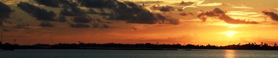
A tugboat crewman speeds back to his boat as the sun sets Friday night. He came ashore to pick up dinner from Stingarees for his crewmates. The owner of the pretty Fischer motorsailer that was our landmark that stressful Wednesday night, said his was the prettiest boat in the marina until we showed up.
We slipped out of Stingaree at 06:30 Saturday under clear skies, a much more graceful exit than the shaky arrival a few days earlier. As we motored eastbound up the “ditch” a brilliant sunrise added to our lifting spirits. We refer to it as “The Ditch” because the ICW does look like a big ditch, particularly in this stretch of Texas. We soon pass the 100′ tall bump known as High Island, a geologic saltdome and the highest elevation for a hundred miles. Spindletop, the mother of the Texas oil and gas industry is nearby. Longhorn cattle wander about the adjacent pastures. Egrets and Herons fish along the banks. Eight hours later, we left Texas near Port Arthur, and soon dropped anchor behind Shell Island, LA.