For a guy who loves maps, charts, and geography, I’ve apparently been pretty dumb about Jacksonville. I had no idea the St. John’s River was so big. I also didn’t realize that it drains Florida clear down to Orlando. My new appreciation of the St. John’s began as we passed Sister’s Creek, heading towards downtown Jacksonville.
Battling both the river current and outgoing tide, we struggled to make four knots. Lola swims faster, and she can’t swim. Stationary channel markers created whitewater and left wakes. When our projected ETA at Ortega Landing jumped by two hours, I pushed Cirila harder. Well. remember that heat exchanger issue? Letting us know she was in no mood to run at 2000 rpm against the St. John’s, Cirila’s high temp alarm sounded.
After dropping back to 1500 rpm, the temp fell below 200 degrees, and the alarm thankfully quit. Crisis averted! Easing back up to that 1750 rpm happy place we’d been running most of the way from Stuart, the temp stayed below 200, and we clawed our way upriver.
Part of Jaxport
The Saint John’s shoreline is surprisingly industrial, all the way to downtown. Picture Newark or Baltimore. Jacksonville’s “port” is really just ten miles of gantry cranes along the north bank, separated occasionally by secret military stuff. In the channel, trainees for the Coast Guard, Fish and Wildlife, and Sheriff Offices were practicing 40 knot U-turns in inflatable gun boats. A sprawling Maxwell House plant explained the intense coffee smell we picked up two miles downriver. We plodded along, our own wake caused more by the tide than our speed, like the channel markers.
We finally rounded the last bend, where downtown Jacksonville sprung into view. If you wondered what the “Cowford” title of this post means, it’s what Jacksonville was called before 1822. The Seminole called the place Wacca Pilatka, meaning cow crossing, because the St. John’s is at its narrowest where the city stands today. Unimaginatively, the British called it Cowford, short for cow ford. When Florida was taken for about the eighth from Spain, who had only just won it back from the British, its first territorial governor was none other than Andrew Jackson. Pandering to the man who saved New Orleans and subdued the natives, locals renamed the cow crossing in his honor. I like Wacca Pilatka better.
Home of the Jaguars. Not the prettiest of stadiums.
The current eased as we cruised through downtown, still hopeful of reaching the marina while deckhands were still at work. Upon our approach, the bascule railroad bridge lowered, and ten minutes later, a train slower than Cirila going up the St. John crossed. To amuse myself, I throttled us just enough to keep us on station in the river. I wondered why railroad bridges take so long to close, thinking this one was in Georgia by the time the bridge went up again.
Downtown Jacksonville along the St. John’s
We called the marina again as we passed under the I95 bridge south of town. Cam, the harbormaster at Ortega Landing, was still waiting for us as we turned out of the channel towards the Ortega River. The water that rushed passed us in the St. John was now gone, and the slack tide left us looking for enough to float us going in. The Ortega River bridge tender told us this was an exceptionally low tide, but not to worry. “The bottom is just soft mud, you can plow right through”. And that we did, cleaning our prop while our keel did most of the steering.
Cam and others helped us tie up in our temporary slip on C-dock. Right across the dock, bow shadowing us in the evening sun, was another Kadey Krogen 42, this one sporting a Cleveland Browns burgee up front. Three slips away, another one, minus the burgee. On B-dock, yet another, along with a 39′. Looks like a good place to lay-up for hurricane season.
Celebrating or 20th Anniversary
We spent the our first week getting to know the surroundings, our boat neighbors and other loopers, plus preparing for a two week road trip up North. We were going on a family visit – to see kids, parents, and siblings, and most importantly, to meet June Helen Brennan, our new granddaughter. The night before hitting the road, we celebrated our 20th Anniversary at the Cowford Chophouse. It was a wonderful dinner and evening – and we even knew why it was called Cowford!
Northbound to New Smyrna, as Mosquito Lagoon narrows near Oak Hill, rustic fish camps begin dotting the mainland bank. Continuing North, the camps evolve into small campgrounds, then into RV parks, then mobile home communities. By Edgwater, the waterfront is lined with modest single family homes behind ramshackle docks, growing in size as we near New Smyrna.
Edgewater should really define the southern boundary of The First Coast because along with New Smyrna, it was part of the original settlement developed by the Scotsman, Andrew Turnbull. Back in 1768. Turnbull brought some 1,255 Greek, Italian, and Minorcan settler’s through Mosquito Inlet on 7 ships, creating from scratch, the largest English settlement in North America.
Just steps from the marina, remains of a foundation thought to be a manor house Turnbulll was building for his partner
Florida was England’s booty following the Seven Years War, winning it from Spain in 1763. Since Ponce de Leon’s first days, Florida had been Spain’s conquest. They built successful towns and coquina forts in both Pensacola and St. Augustine, but their resources were stretched thin. The same Paris treaty which ceded Florida to the British, awarded Cuba to Spain, so the Spaniards packed up and sailed to Havana, leaving Florida for good.
New Smyrna’s quaint City Hall
New Smynra’s harbor lies just North of the 65′ Harris Saxon, A1A bridge. We passed its large anchorage, turned sharply to port around the River Deck Restaurant, and backed into slip 39 at the New Smyrna Marina for our three night stay. I envisioned the same harbor full of Turnbull’s ships 250 years ago, or Ponce De Leon’s 250 before that. Imagine, anchoring your schooner in uncharted waters, rowing ashore, and starting a new life with just a bag of seeds, clutch of chickens, and bucket of nails.
We timed our journey so that our stop in New Smyrna would coincide with a vacation to the area by Dawn’s brother Gary and his wife Kathy. They drove over from their rented beachfront condo, joining us on the boat for cocktails before we strolled into town for dinner at the Yellow Dog. (best pulled pork tacos I’ve ever had!). Two nights later, we headed their way for a seafood dinner on the deck at JB’s Fish Camp. The mosquitoes there may still be discussing the delicious human dinner they shared.
With Gary and Kathy Krueger at JB’s Fish Camp
Adjourning to the condo for cigars on the deck, we made a valiant effort to finish off Gary’s Bourbon before their morning flight home. We were celebrating the birth of our second grandchild, June Helen Brennan!
We cleared out at 07:30 the following morning, for a five hour run North to Palm Coast. The first hour wound through brackish fishing grounds in the cut behind Ponce inlet, before emerging in the Halifax River in South Daytona. Saturday morning in Daytona! The channel was jammed with center consoles sporting up to five outboards, beer flowing faster than gasoline.
The Halifax through Daytona is not particularly scenic, but it does get pretty near Ormond Beach, and especially Ormond-by-the-Sea. There, the Halifax narrows and for some reason, becomes Smith Creek. Save for two trawlers 1/4 mile ahead, there was little boat traffic as motored North. Covered boathouses just twenty feet off our starboard beam matched architecturally with homes behind, live oaks and pine shading the banks.
Near Flagler Beach, boat traffic picked up again, fed by small marinas and docks, amenities built for the many low rise condos along the waterway. These are the cheap seats for snowbirds and retirees. Just beyond, as we near Palm Coast, those seats get pricier. Country club developments line both banks, first Grand Haven, then Hammock Dunes. In the midst of it was Palm Harbor Marina, where we tied to the sea wall overnight.
The Ponce Inlet Lighthouse
We chose Palm Harbor so we could time our arrival the next day in St. Augustine at slack tide. This allowed for a full, leisurely breakfast, rather than our usual protein bars en-route. From Palm Coast, Smith Creek becomes the Matanzas River, another puzzling name change. My theory is that early mariners made these trips “outside” in the Atlantic, and it wasn’t until the last century that many of these inland waterways were connected to become the Intracoastal Waterway. Smith Creek probably flowed South, the Matanzas North toward St. Augustine, rivers probed and named by the explorers before they were connected.
Boating guides are full of cautionary tales about docking at St. Augustine’s Municipal Marina. The tidal current runs through it at 3 knots. We were coming in at close to slack tide, which would negate this impact, but the strong winds were worse. We circled in the harbor until the deck hands were ready for us, talking us in on the VHF. I abandoned our first attempt as the wind pushed us beyond our target and nearly icrashed us against the outer dock.
We would have enjoyed a longer stay in Staint Augustine, but were pressed by oncoming weather.
After re-aligning, the dock master hollered over the radio “Back right at the black-hulled sailboat. Right at it with purpose!”. The stern was generally on track, but our bow was falling off the wind, the bow thruster unable to overcome the windage. Dawn got the stern lines to the deckhands as we became increasingly perpendicular to the slip. It was like trying to put your foot into a shoe sideways. Through a team effort, we got Cirila into her slip with gathered onlookers cheering. We took some hide off the swim platform, but thankfully, didn’t hit any other boats. It was the most challenging docking experience we’ve had; our adrenalin didn’t ebb for two hours.
The City Marina is worth the stress because it lies in the heart of Old St. Augustine. We stayed just one night, eager to get to Jacksonville before a long string of stormy weather settled in. Making the most of our stay, we ate Italian at Pizzalley’s, then grabbed a hightop at the Tradewinds Lounge to listen to some music. The band’s opener hooked us – an excellent cover of “Melissa” by The Allman Brothers. Yuengling drafts were $4, so we stayed for two sets. It was the first quasi-normal night out for us since the pandemic began.
A quaint cottage overlooking the ICW in Florida’s First Coast. These places have $100K of patio furniture, but know one ever using them.
The landscape grows more industrial after passing under the 202 bridge, on our way to the intersection of the Saint John’s River. The outgoing tide had us speeding along at over 10 knots with the engine running only 1600 rpm. I was nervous about the intersection, as a shoal had developed in recent months, grounding numerous boats and forcing the Coast Guard to move the channel markers. We never saw less than 9′ depths, but having just been in 30′, I was looking at our depth gage – a lot. We made it safely into the Saint John’s River, then on to Ortega Landing just beyond Jacksonville, but I’ll save the rest of that story for another post.
Before closing this one though, a bit more history. Turnbull’s New Smyrna story didn’t end happily. For him, it was a money pit. For the indentured servants who settled it with promises of land grants, it was soul-sucking hardship. Hurricanes, hunger, disease, and drought killed half of them. With St. Augustine just a day’s journey up the “road”, and already established for over 200 years, the settlers abandoned New Smyrna in 1777, creating perhaps America’s first ghost town. By about this time, there were also a lot of crown Loyalists flocking south from Charleston and Savannah, run out by pesky patriots starting a new country. The early American’s wouldn’t leave the Brit’s alone, eventually chasing them out of Florida as well, after only twenty years of colonial rule. While many escaped to Bermuda and the Bahamas, others sensing great golf and real estate opportunities, joined the cause. Florida became a US Territory in 1821, and the Union’s 27th state in 1845.
Florida’s Space Coast is loosely bounded by New Smyrna in the North, and Vero Beach to its South. Some will argue the point. In another 30 years, Florida’s tourism bureau will probably add another dozen coastal names, so any argument is moot. They’re already lobbying for the Surf Coast to be added between the Space Coast and “First Coast” to the north, which would include Daytona. Personally, if anything, I think that should be the Race Coast. These are the important things for Florida’s Legislature to debate instead of making it harder to vote.
What defines the Space Coast is Cape Canaveral, Merritt Island, and the waterways that separate them from each other and the mainland. Ponce De Leon explored the area in 1513. He named the entry inlet “Mosquito Inlet”, and the lagoon stretching South to the cape, “Mosquito Lagoon”. He called the outer barrier island Canaveral, or “Place of Reeds”, and the inner lagoon, “Indian River”, for his welcoming committee. It was an unlikely place for the Fountain of Youth.
Relatively desolate and isolated by the poor navigability of its waters, the Space Coast missed Florida’s development boom – until rockets. It was a good place to launch rockets, especially in the early days, when they blew up a lot. The closer to the equator, the better. Few people and nothing but water to the east made it ideal. Elon Musk bought up Boca Chica, TX for the same reasons. The government built a deepwater port in the 40’s, then started shooting off rockets in the 50’s. Florida’s tourist Bureau renamed the Mosquito inlet to “Ponce” Inlet hoping more people would come, but it was Apollo, Ron Jon’s Surf Shop in Cocoa Beach, and I Dream of Jeannie that fueled the boom. The rest is history.
We arrived at the Cocoa Village Marina mid-afternoon after an uneventful cruise up from Vero Beach. The Marina is compact, clean, and convenient to both the town of Cocoa Village and the Intracoastal Waterway. We stayed a couple nights, giving us a chance to explore the town, and watch the Falcon 9 launch scheduled the following day.
Cocoa Village – Quaint but empty
We scrapped plans to restock Tee-shirts at Ron Jon’s, as a one way Uber to Cocoa Beach was $30 for the straight, seven mile drive. The bus was only $1.50 but took over an hour each way. Either option was too much for tee shirts! We opted instead to watch the Launch from our dock, then go into town for dinner.
The launch was scheduled for 3:01. We were about ten miles away with a clear view over the waterway in the direction of the cape. My Nikon, telephoto, and tripod were prepped and set up by 2:30. By 2:45, other boaters began to cluster on the dock, then one boat began broadcasting the Nasa feed on their radio. With five minutes to go, I took a few test snaps, checking the autofocus. Then the battery died. I scrambled to grab the other from the pilothouse, and snapped it into place. Click click, back on line. Ten, nine, eight…..
About 3 seconds after liftoff, we could see the sharp tongue of yellow-white flame rise up over Merritt Island. I switched to movie mode to capture the amazing slowness of Falcon’s initial ascent, then its acceleration. The roar reached us 10 seconds later, as the rocket arced into its escape trajectory. It was an awesome sight.
Friends saw the Falcon 9 Heavy crew launch at night a few weeks prior from their anchorage, even closer to the cape. Jim captured breathtaking video of that launch. Unfortunately, I flubbed my entire suite of camera settings, capturing the whole affair in an overexposed mess of pure whiteness. Dawn captured a good video on her phone, but I’ve had difficulty uploading it here.
Later that afternoon, our masked faces were greeted with stares upon entering the George and Dragon Pub. Waiting for our Black $ Tans, a wiry guy at the bar chatted me up as I scanned the humidor cabinet for a cigar to enjoy on the patio. He was sharing enthusiasm for his new place in The Villages, joined soon by his botox inflated wife. I skipped the cigar and joined Dawn on the patio, where a one man band rendered a dismal Jimmy Buffet. Between songs he pandered to the self-proclaimed “Patriots” at the table behind us. We chugged our beers, made a hasty exit, then walked the block to Villa Palma. We thoroughly enjoyed the food and service there and recommend it highly.
The Porcher House in Cocoa Village
We slipped lines at 7:30 the next morning, bound for New Smyrna. It was a lovely cruising day, warm but with a light breeze out of the East, cooling us through the open doors of the pilot house. Passing Titusville, the massive Nasa Assembly Building comes into view, visible as a giant gray brick on the horizon. Its hulk remained in view almost the entire day, finally fading out behind us as we approach New Smyrna.
The journey takes us through the headwaters of the Indian River Lagoon, then East through the Haulover Canal, where we run right over top of a couple large manta rays. Emerging into the Mosquito Lagoon, we resume our northward heading. Small islands separate us from the marshland to the west. To starboard, a couple miles of flat, shallow lagoon separate us from the northern reaches of Canaveral National Seashore and the Atlantic beyond. It is the most remote section of Florida coast we have seen, and other than the few fishing boats chasing speckled trout, and the big gray brick on the horizon behind us, is probably much the same as Ponce De Leon found it a half millennia ago.
Not since our first days after leaving Houston eighteen months ago, have we travelled North. On a sunny May Day morning, we loosed lines and left our slip at the Harborage in Stuart, FL, provisioned for a two-week journey, northbound to Jacksonville.
It was a milestone departure. While wintering in Stuart, I sought counsel to learn how to better deal with the intense anxiety I often feel in advance of a cruise. It wasn’t always this way and it was getting worse, becoming debilitating. After a decade of planning and preparing, falling prey to such demons was depressing. I’m happy to share that the counseling worked wonders. Knowing we were prepared, and focused on the moment, we entered the St. Lucie River, happy to be underway again.
Fifteen minutes into our trip, as we cleared the A1A bridge leading to Sewell’s Point, Dawn asks “All systems look good?”. Scanning the instruments again, I reply “No, not really, we’re running hot.” Our engine exhaust temperature was reading 220 F, 10% higher than normal for the rpms we were turning.
Dawn circled in the channel at idle speed, while I went to the engine room to check the strainer, coolant, and water flow. Everything appeared normal. Retaking the helm, I kept us at about seven knots, and our exhaust temperature stabilized. Making mental note of contingency destinations, we pressed on, knowing that turning back would have been capitulation.
We turned North into the Indian River where the St. Lucie Inlet offers a brief glimpse into the Atlantic. Between there and Fort Pierce, twenty miles to the north, the inner coastline rises high above the Indian River. If sea levels rise six feet, these folks will be safe, and better still, will be ocean front on the new barrier island. It takes an hour to round Sewell Point and reach the Jenson Beach bridge, a ten minute care ride from The Harborage. The waterfront homes gradually shrink as we approach the nuclear plant perched on Hutchinson Island.
Nearing Fort Pierce, the waters brighten, as silt, sediment and nutrient runoff are diluted by ocean waters near the inlet. The transformation is remarkable, and a joy to experience at each inlet along the coast. Just beyond Fort Pierce, Jack Island and dozens more dot the outer boundary of the Indian River. It’s Saturday, so small boats are beached along the sandy shores of these small islands. Tents are pitched under the palms. Fishing, swimming, and beer drinking rule the day.
We approached Vero Beach mid-afternoon, thirty minutes behind schedule because of our reduced running speed. The Municipal Marina, tucked into small cove behind Fritz Island, is well protected and quaint. It feels like a step back in time compared to the newer corporate marinas which charge for amenities seldom used. It’s an easy walk for Lola to the grass under huge live oak trees which shade the grounds. Above all, it’s very peaceful. Lola liked it and so did we, thus we decided to stay a second night.
Sunset on the Vero Lagoon
After a sound sleep, and as the sky began to brighten outside the stateroom portholes, I noticed something was not right. Our freshwater pump was kicking on every five minutes, and the bilge pump was running more frequently. You get to know what all these things sound like. We had a leak somewhere – a dripping faucet, or head, or leaking water heater. I jumped out of bed, and before making coffee, started searching. Climbing down into the engine room, it didn’t look good. Water was dripping down the back of an electrical junction panel in the engine room. Limited access made it very difficult to find the source. Ten minutes of contortion and cursing later, I found and fixed it – all except for a soaked relay, critical to our autopilot. I’ll fix that one later.
The little warbler regaining consciousness
During my cursing, Dawn thankfully made the coffee and I finally settled in the cockpit to enjoy a cup. I almost lost the fourth sip when a school of flying fish took flight just off the stern quarter. Two flashing leaps, then gone. Halfway through my second cup, and almost done with my morning Words With Friends ritual, came a sudden “thunk” just over my head. At my feet lay a small bird, knocked silly trying to fly through the window behind me. I think it was an Orange Crowned Warbler. I cradled it in my hand, as it lay on its side. One leg didn’t work, one eye was shut. Dreading feeding him to the flying fish, I waited. Fifteen minutes later, he stood perched on my hand, looking better but still afraid to attempt flight over the water. I decided to walk him to the bougainvillea growing along the bank. Halfway there was close enough – he took off and was gone.
Late that afternoon, we dinghied to the Riverside Cafe for dinner, a classic waterfront eatery and drinking establishment along the Vero Lagoon. It’s a recommended stop; their Bang-Bang shrimp are outstanding! Soon after we got back to Cirila and stowed the dighy, dolphins entered the small lagoon to feed. We sat on the bow, mesmerized as always, by these happy creatures. They jumped, rolled, and might have even been doing a little mating, right off our bowsprit. What an unexpectedly interesting day!
Always fun to see Cirila from the dinghy – tucked in at Vero Beach City Marina
Northbound in the Indian River before 7:30 the next morning, we crossed the unmarked boundary between Florida’s “Treasure Coast” and its “Space Coast”. Exquisite waterfront homes line the twisting waterways near Vero for the first hour. These are the kind of places with statuary by their pools, bronze and marble tributes to dolphins and sea turtles, David and Ben Hogan. The unaffordable housing gives way to nature at the Pelican Island Preserve, where the Indian River widens. I looked up from our instruments only to be startled by a bald eagle, crossing our path twenty feet in front of the pilothouse, close enough to see the gleam in his eye, a fresh caught fish still flopping in its talons. Unfortunately, it happened too quickly to reach the camera.
If the Indian River sounds familiar, it’s probably because of oranges. Though you’ll see orange groves all over the state, it was the Indian River district near Vero that started it all. Henry Flagler’s Florida East Coast railroad put fresh oranges within easy reach to millions. Didn’t we all sell bags of Indian River oranges for grade school fundraisers? During WWII, researchers figured out how to concentrate the juice, freeze it, and ship it to the troops. A marketing consultant was hired, and Minute Made was born. We all know fresh squeezed is best, and if you grew up in Ohio in the 1960’s, you probable still can’t shake the jingle from Lawson’s, a convenience store ahead of its time. On the commercial, as gleaming stainless tanker trucks cruise the highways, the singer belts out “Roll on Big “O”, get that juice up to Lawson’s in 40 hours.”
The swarthy crew, happy to be on the move
Near the Sebastian Inlet, the river grows clearer, deeper, and bluer. For the remainder of our seven hour cruise to Cocoa Village, the waterway was a mile or two wide, more like a bay, and big enough for the breeze to kick up a light chop. On its distant banks, the houses become more austere, the foliage more coniferous – decidedly less palmy. Bridges are few, and all have a 65 foot clearance. We are no longer in South Florida. Hopefully we’ve left my demons behind.
Since crossing the Okeechobee last November, Slip B57 at the Harborage Marina in Stuart, FL has been home. We’re not the only Loopers with plans modified by the pandemic. In theory, a boat is the ultimate platform to self-isolate and ride out a pandemic. It’s why boats and RV’s are selling like chocolate covered hotcakes. But we’re not those boaters trying to get off Zoom, or get out of the house for the weekend. This IS our house.
Loopers like to get off the boat (out of the house) to explore places along their journey. With restaurants serving take-out only, museums closed, docktails, potlucks, and even Canada off-limits, the Looping experience is greatly diminished. Then of course, there is the issue of needing to be in your home state for a vaccination. For us, that’s Florida. For all of these reasons and a couple more, we’re still here. We’ve had our first dose, and in a few weeks, we’ll get the second poke. Afterwards, we head North.
A View of The Harborage Marina, Stuart FL, just after moonrise
Being voluntarily “stuck” in South Florida during the winter doesn’t invite sympathy. Back in January, we actually wore jeans and socks for a few days. Since they share our conservatism about wearing masks and respecting viral outbreaks, we’ve spent several weekends with our great friends, Brian and Virginia Eamer. They own a dirt home nearby, and we’ve exhausted our guest privileges at their golf club. Our stay here has been no hardship, just borne of A Change of Plans.
After settling into the Harborage last November, we retrieved the car from Fort Myers, and took a road trip North. Driving from Florida to Michigan in November seems foolish by most accounts, but Dawn’s folks needed some help, and we wanted to welcome a new family member. Yes, we became grandparents, and held Theodore Thomas Jeglic in Lansing on his two-week birthday. Side trips to Gross Point, Cleveland and Columbus spiked our joy meter, despite COVID protocols. Our expected ten day trip stretched to nearly a month, allowing us to celebrate Thanksgiving with family.
A splendid Christmas with the Eamers was followed by the gut punch of January 6. The insurrection and those turbid weeks leading up to it explain my scarcity on social media. It’s why the blog is relatively quiet. You see, the boating community seems to have a disproportionate number of folks who countenance those events. I struggle to reconcile and struggle to write while coping with my disgust.
We emerged from our insurrection blues by cruising south to Lake Worth, to visit Jim and Melissa Kelly. Our friendship began during the short time we were marina-mates, back in Houston. Boat issues and work delayed their Houston departure. Then more boat issues and a few hurricanes stalled their progress along the Emerald Coast. They finally caught up and were en-route to the Bahama’s!
“On Course at Last” on Lake Worth, the night before crossing to the Bahamas
Since I’ve mentioned the Emerald Coast… Here the Treasure Coast stretches between Vero to Palm Beach, and is named for a Spanish Treasure Fleet lost in a hurricane three centuries ago. Just offshore, the mighty Gulf Stream surges between the Bahamas and Florida’s peninsula. It’s where the ocean’s strongest current makes its closest approach to land. In a Northeaster or tropical storm, the waters can rise up and swallow boats.
Our cruise to visit the Kelly’s marked our first traverse along the Treasure Coast. Staying “inside”, the journey from Stuart begins southward, through The Saint Lucie Inlet Preserve. This natural and pristine section of ICW is a known haven for migratory birds, like the Peregrine Falcon and American Kestrel. And we thought they were all Ospreys! At Hobe Sound, where Jupiter Island stands between the ICW and the Atlantic, the pristine bows to corpulence. We motor past the estates of Tiger Woods, Michael Jordan, Celine Dion, Rory Mcllroy, not to mention the one Greg Norman just sold for fifty million. Backyard stairways make the Supreme Court’s edifice look paltry, and boathouses could shelter families of eight. Opposite, on the west side, wannabe’s in lowly seven figure homes settle for pools, putting greens, and docks crowded with water toys. No humans are to be seen, making me wonder if they’re all inside, hiding from their wealth or their debt.
The Jupiter Lighthouse marks the inlet and looks over some of the prettiest water we’ve seen
Just past Tequesta, as one approaches the Jupiter inlet, the water transforms into azure splendor. This is where Burt Reynolds chased Lonnie around the pool, and Joe Namath still films Medicare commercials. The Jupiter lighthouse guards the point, bridges slow progress, and boat traffic intensifies as we round the bend, continuing south, towards Juno Beach. At North Palm Beach, the waterway pops out into Lake Worth, which stands between eight towns named “Choose-Adjective” Palm Beach. I think 90% of the1% live nearby.
We found Jim and Mellisa and their pretty Grand Banks Classic, “On Course At Last” opposite the mega-yacht basin. We dropped anchor and spent three fun-filled days together, eating, drinking, laughing and sharing boat tales. It was the longest we’ve spent at anchor since leaving Houston! We saw them off before sunrise, waving as they headed out the inlet to cross the Gulf Stream.
A boating billboard cruises past the mega yacht basin, where I was ticketed for leaving a wake behind our 11 foot dinghy
I’ve enjoyed learning some local history at our stops along the way. One of the most fascinating takes us back to the Herbert Hoover dike, (No, not J Edgar) which surrounds Lake Okeechobee like the walls of of an above ground pool.
In 1928, after pummeling Guadaloupe and Puerto Rico, a Category 4 hurricane made landfall in Palm Beach. On approach, its circulation caused a tremendous storm surge to breach the levees of Lake Okeechobee, inundating the rich farms to its south with twenty foot floods, killing thousands. As the hurricane passed, its reverse circulation pushed floodwaters over Okeechobee’s northern bank, killing hundreds more. The Herbert Hoover dike was built in response.
The 1928 Okeechobee Hurricane was the third deadliest in US history, after the Galveston Hurricane of 1900, and recent Hurricane Maria, which devastated Puerto Rico. Most of the Treasure Coast was smashed; half the homes surrounding Lake Worth were destroyed. The mortar of Jupiter lighthouse was squeezed from between its bricks “like toothpaste”, canting the lighthouse some 17″ after the storm.
Most of the 2500 casualties were poor, black migrant farmers. Their bodies were either burned in large funeral pyres, or thrown into mass graves in West Palm Beach and Port Myacca. Authorities reserved the few available caskets for white folks, burying them separately. A proper memorial did not come about until just twenty years ago!
Zora Neale Hurston wrote of African American life in the early 20th century South, and explored the effects of the 1928 hurricane on black migrant workers in her seminal 1937 novel, Their Eyes Were Watching God. It is regarded as one of the 100 best English-language novels published over the last century. I can attest – it’s a remarkable story, masterfully told.
In another interesting piece of history, Hurston spent her last years at a senior home just north of here, in Fort Pierce. Upon her death in 1960, she was buried unceremoniously in a nearby cemetery. No stone marked her grave. The cemetery was of course segregated at the time, and Hurston died poor and black. Today, history regards her as one of Florida’s ten most iconic novelists, along with the likes of Marjorie Rawlings, John McDonald, Elmore Leonard, and Ernest Hemingway. I’d read her over papa.
We decided to cross from the Gulf to Atlantic side of Florida via the Okeechobee Waterway instead of around the Florida Peninsula through the Keys. Time, expense, hurricane season, and depth factored into our decision. Now, in hindsight, it was a great call, because Hurricane Eta made landfall about ten miles from where we planned to stay.
The Waterway was a public works project during the depression. Many cool things for boaters came about during the depression. The TVA system is another example. Okeechobee is that big lake in the middle of Florida, and surprisingly, is the second largest freshwater lake in the contiguous US. A large dike named after Herbert Hoover surrounds it. To the West, the Caloosahatchee River and canal drain to the Gulf, while the Saint Lucie River and canal system drains water to the Atlantic. Since Lake Okeechobee is about 15′ above sea level, three locks and dams control water levels on the Caloosahatchee, while just two handle the drop on the St. Lucie side.
In the week before our planned departure, I changed the engine oil, raw water impeller, and pencil zinc in the heat exchanger. These were firsts for me, and first oil change since leaving Houston. It was easy work, but as usual, I was sore for a few days from crawling around in the engine room.
A pretty little haven along the Caloosahatchee
Slow boats like ours make this 135 mile trip in two or three days. We opted for two, with a planned overnight in the fishing haven of Clewiston, on the South side of Lake Okeechobee. As usual, my nerves jangled in the days before our departure, making me wonder what astronauts go through. Navigating the locks and crossing Okeechobee were my main concerns. Because it’s shallow, Okeechobee can get very rough in a blow and we were targeting a weekend weather window forecast to slam shut the Monday after our trip.
Leaving Fort Myers just after sunrise on Saturday, we turned upriver and into the heart of Florida. The river is wide until one passes under I-75, laden with RVs full of returning snowbirds. The first bridge, the Wilson Piggot, opened on command, barely slowing our inertia before arriving at the Franklin Lock. Its tender, Sonny, made it an easy and pleasant experience. From atop the lock wall, he chatted with us about the trip ahead. As it winds inland, the Caloosahatchee is bordered by small oxbows, most with docks and homes tucked behind mangroves and cypress lining the banks. Beyond the lift bridges marking the small towns of Alva and Labelle, we came to the Ortona Lock. Its tender was no Sonny, forcing us to guess where and which side of the lock to tie up to. We locked without issue, pressing East as the waterway evolves from river to canal. The fifteen miles to Moore Haven, on the West side of the lake, would have been boring if it were not for the exquisite rainbow we chased for over an hour. We tried to sail under it, but could never quite get there.
Going up about 6′ in the Ortona Lock
The municipal dock in Moore Haven was our fall back overnight spot, but locks and bridges went so smoothly that we had time to make Clewiston. We waited for a train of sugar can pulp to pass before squeezing through the narrow swing bridge and into the Moore Haven lock. Emerging on the opposite side, we turned right and into the waterway bounded by Hoover’s dike to starboard, and the marshy edges of Lake Okeechobee to port. There, we caught up with the rain causing that beautiful rainbow. For an hour it came down in buckets, our visibility marginal because the center wiper that failed us back on Lake Pontchartrain quit again. Thankfully, the channel was wide and boat traffic minimal. About 10 minutes from Clewiston, the storm passed and we cleared the small lock protecting Roland Martin marina on the opposite side.
The shallowest rainbow I’ve ever seen
Since staff was gone for the day, we picked a spot along the dock, tied up, and took an anxious Lola out for some relief. We ate and had a couple drinks at the Tiki Bar, a fairly famous stop along the way, judging by the number of tee shirts and other swag for sale. The ten hour day on the water zapped our energy so we called it an early night.
On the opposite side of Okeechobee is a lock called Port Mayaca. Our friends on Golden Daze (remember them from the crossing?) traversed it two days before, when it was on emergency generator power. It closed for the day soon after they locked through. After confirming that it was back up and running, we left Rowland Martin in early light, waited an hour behind a line of fishing boats to clear the lock, then made our way out the channel and into Lake Okeechobee.
Unlake northern lakes, Okeechobee doesn’t have a very definitive bank. We followed a marked channel through thickets that became wetlands that eventually became the lake. We chose the shorter route that zig-zags across the lake, seeing only one other boat during our four hour crossing. Conditions were ideal and on the final heading, our autopilot guided us through bands of neon blue green algae on our way to Port Mayaca. We locked through with Mark and Yvette Clark, (on that other boat) who were returning home to Stuart with a sailboat they just bought in Port Charlotte. Unfamiliar with its fuel system, their engine quit just as they entered the lock. I’m not sure why you’d buy a used sailboat when you circumnavigated twice on your old one. Maybe they just wore it out. We waited with them while Mark worked the fuel supply, got their engine back online, then steered out the St. Lucie canal, Eastbound.
Our autopilot kept us dead on course as we sat on the foredeck, enjoying the calm
Mile-long straightaways made for an uneventful, if not boring motor through the farmlands of central Florida. Nobody won our contest for who would spot the first alligator. Occasionally, small racing boats would zip by on either side, shooting up rooster tails, but leaving little wake. The scenery grew more compelling the further east we travelled, with waterfront homes slowly growing in size and gaudiness.
An hour past Indiantown, we approached the Saint Lucie Lock and Dam, holding station for about 15 minutes while the chamber filled. Along with 3 other boats, we dropped 13′ to the South fork of the Saint Lucie River below. Continuing East, we passed under I95, then The Florida Turnpike, more RVs southbound, and into the wider waters around Stuart. Awaiting the Roosevelt bridge opening, we idled 100 yards off Brian and Nataly’s yacht, FitNautic, resting in her slip at Sunset Marina. We were livaboard neighbors in Houston two years prior!
Lola Dogging the helm while we crossed the Okeechobee
Under the bridges and around the corner, we made our way into slip B-57 at the Harborage Yacht Club and Marina. Some folks know it as Loggerhead Marina, but that was before Hurricane Irma destroyed it in 2017. Though the slip is a bit tight, the facilities are first class – for all except for Lola. Patches of grass are small, few, and far, but I suppose they are rich with smells. We got the collapsable wagon out to help ferry her to her dumping grounds.
The day after we arrived, winds picked up as forecast. Winds started at 15-20 that Monday, and by the weekend, with Hurricane Eta churning off the Florida Keys, they got downright nasty. Weary of a week of rocking, we spent last night at Eamer’s house as the worst of the storm came through. Cirila made it through the night with a couple bumps and bruises, but nothing major. A few other boats were not so lucky. Now, the winds continue to settle, and we look forward to a calmer week so we can tend to some boat chores and plot our next move.
If things go as planned, we’ll be departing Fort Myers in a few days, after an unexpected, Covid induced, eight month stay. Yes, eight months in slip H1 – long enough to make friends of some locals, get to know a handful of golf courses, and pick favorite restaurants. Long enough also to enjoy week-long visits by Dawn’s brother Gary, her daughter Kayla and boyfriend Sajid, and my son Ben. Fort Myers has been a great place to be stuck, but we’re anxious to move on, to get our journey underway again.
Before we sail ahead of the story, its worth sharing some of what we’ve learned about South Florida, and specifically, the Everglades. Between Fort Myers and Marco Island to its south, lies a 50 mile expanse of golf courses, 55+ communities, and strip malls. They compete for your 401K dollars by wowing Northerners with palm lined drives, fountains and gaudy stonework. South of Marco, however, in an area called the Ten Thousand Islands, one discovers what South Florida looked like before Thomas Edison invented snowbirding.
Deep in the Swamp
We hoped to see the Ten Thousand Islands by boat, on our way to the Florida Keys. Covid forced an audible, so we chose to do our exploring by car. It’s just as well because boating there is probably better in a flat bottom skiff, armed for gator, doused in DEET, and triple wrapped in mosquito netting. Mangrove swamps blur a coastline probably best defined by water salinity, where shallow inlets drain the Everglades.
The Rod and Gun Club, Everglades City, FL
From South Naples, and Marco Island to the west, the old Tamiami Trail continues into the glades, before intersecting Rt. 29, a secluded two lane that plunges deeper south, to the town of Evergade City. A good friend we’ve made in Ft Myers, Mike Alexander, loaned a piece of classic Florida Literature set in the area, called “Totch, A Life in the Everglades”. Its author, Totch Brown, grew up in and around Everglade City, and his book informed our tourism. Totch grew up fishing mullet, but over his long life, found more lucrative work learning to catch Stone Crab, poach aligators, and smuggle weed. Quite the character, and a great read.
Cashier stand at the Rod and Gun Club
First and foremost, is a place called the Rod and Gun Club. The historic hotel lies on the south bank of the Barron River. Calling it a river would be stretch for some, as it flows in either direction, depending on the tide. You can get there by boat if you don’t draw more than five feet of water, or don’t get lost or eaten by skeeters first. The Rod and Gun Club is a time capsule to the guilded age, when it was built on the original foundation of one of the first white settlers. Five presidents have stayed there as have Hemingway, Connery, Wayne and Jagger. Tarpon, Otter and Osprey fill the walls. Hundred year old Gators and Panthers look down on a gorgeous pool table even older. We ate lunch there twice, the food not much to write home about, but the beer cold and the ambiance unforgettable. If you ever go, try the fish reuben.
The Smallwood General Store Museum
Further down and at the end of the road is the village of Chokoloskee. If all you like to do is fish, or perhaps run a meth lab, you might like it. It’s a mobile home on stilts kind of place. No offense to the locals, but I won’t be booking an AirBnB there. At road’s end is a place called the Smallwood Store, now a museum. Totch wrote about it extensively, as it was the only place around to buy supplies, from bullets to tobacco, cornmeal to carburetors. It was the Sears of 1900, at the end of the world. The museum is the store, all the old stuff still filling the shelves.
The soap dispenser in the lower right is the only plastic in the Smallwood Store
Going back up Rt 29 and turning right, one enters the Big Cypress National Preserve. A few miles beyond the Indian village of Ochopee, you cane take a turn south on a dirt two track aptly called Loop Road. Ben was with us on this twenty mile journey through the Jurassic, hoping to spot an alligator in the wild. We counted 29 before emerging again on the Tamiami, at the town of Pinecrest. One 15′ grandpa lurched towards us, chasing us back into the car, hearts pounding.
It’s primitive and primordial. Between mosquitos, hurricanes and rising seas, those choosing to live there are hardy souls!
one of 29 Prehistoric Beasts we observed from close range
Sorry it’s been a while since I wrote. I’m kind of lazy and would rather sleep than write any day. I think it’s still summer. It’s hard to tell because it’s always warm here. I know because it’s light for breakfast and dinner. Sometimes it’s downright hot. Panting doesn’t cool me down enough. Maybe my tongue is too small.
Something has been weird lately. People don’t come on our boat anymore. Not since Miah was here with her mom and that guy with the furry face. Even when we go for walks, people don’t pet me as much. Usually, I’m not even allowed to go smell their ankles. That’s the main reason I like to go for walks. It’s sure not for the exercise.
Another weird thing is that Mom and Dad are here a lot. I’m not complaining, because I get to sit on mom’s lap more. But sometimes, I like to have the boat to myself. I can take really long naps without all the distractions. That’s when I have the best dreams.
I don’t think this was a dream but last week, we were in the car all day. When I finally got out, I was near where I grew up. I could tell by the way the air smelled. I couldn’t see very far because there were huge trees and plants everywhere. Mom and Dad’s friends were there, which confused me because we usually see them in the house with all the slippery floors. I can barely stand up in that place!
This time, there were even more of those really big dogs. I counted three, which is about as high as I can count. I’m just assuming they’re dogs, because they smelled like dogs. But they’re almost as big as those horse things we had when I was growing up. They have really hairy faces too. It covers their eyes so I can’t tell what they’re looking at. Since I can’t see what they’re barking at, I just join in anyway. I think I scare them a little. You wouldn’t believe the size of their food bowls. I kept hanging around hoping I could steal some of their food. It worked once, but after I got caught, they never left those giant bowls on the floor anymore.
Speaking of food, I eat this really good stuff now. My old food was really dry and Mom thought it scratched my throat and made me cough. The new stuff is softer and swallows easier. I know, I should chew it, but I only have 3 teeth left. I’m impatient too, because I can’t wait ’til it hits my belly. It kind of tastes like baloney, but not as salty. I like it. The bad part is I don’t poop as big now. It’s like I’m a rabbit or something. It’s embarrassing.
We haven’t been going on many boat rides lately. That’s OK with me though. This is a good place and even though I don’t get to socialize much, there are a lot of other dogs here. There’s a nice place we all walk. It’s not far either, which is good if you’re lazy like me. There’s this one little dog named deee-oh-geee, like how people spell DOG when they talk behind your back. (They think I don’t know how to spell TREAT). Crazy name though huh? Anyway, D.O.G. is really small and pees on everything. Bike tires, cement pots, sidewalks, light poles, and a bunch of other stuff I don’t even know the name of. I don’t know where he gets all the pee. He’s like my old friend Sancho, but with less manners.
Another crazy thing here is the rain. There’s a storm almost every day, right about dinner time. I’m not even scared of the thunder anymore. I don’t like walking after a storm because my feet get wet, then I’m not allowed on the couch. My toenails grow really fast here. I don’t know what’s going on. Mom thinks it’s because it’s warm all the time. Whatever. I don’t like it because I have to get them trimmed more. I hate pedicures.
What else can I tell you? My legs are starting to get wobbly again, but not so bad as a couple years ago. I can still get around okay though. You should have seen me with those big dogs. I was actually running. It felt great, but was I ever sore afterwards. I fell on my face once but it didn’t hurt. It was cool there because I could just wander around outside. I lost my bearings once when I wasn’t paying attention, but dad was watching. It was scary.
Dad just opened the refrigerator. I have to go now. Bye.
When the Coronavirus scuttled our plans to be in the Keys last April, we decided to stay in Fort Myers. We’re still here, but we’ve both been busy. Not only have we gotten our golf clubs out, but Dawn’s been working towards becoming a certified Aromatherapist, and I’ve been writing. Not much on the blog, but on a project I started many years ago.
A Change of Plans” is my debut novel. The story begins with an obvious autobiographical slant (especially if you read our blog), but soon involves four Columbian siblings caught up in the drug trade, often against their will.
Like us, Jake and Gina Adams sell everything to buy a boat and go cruising. As their adventure begins, they discover that their boat’s prior owner had a secret past, one that puts them in mortal danger.The couple must join forces with a few of the dead owner’s old friends to unlock his secrets, then together embark on a quest to beat traffickers to millions of dollars they believe is buried in the Virgin Islands.
In a race against drug cartels, time, and the law, all paths cross near Tortola, in a fantastical maritime adventure about friendship, trust, redemption, and ultimately, a change of plans.
Follow the links below to order your copy:
Amazon – available as ebook for Kindle or in Paperback.
Before we share thoughts on our time here, how about a little history? Fort Myers lies along the southern bank of the Caloosahatchee river in Southwest Florida. Local natives, the Calusa, knew about this place for a few millennia, earning them not only the naming rights to the river, but squatters rights to the best real estate. Places you’ve heard of like Fort Myers, Naples, Sanibel, Bonita Springs, Marco Island – all were Calusa territory, until Ponce de Leon started poking around in the sixteenth century. Spanish missionaries tried to save the Calusa from themselves, offering salvation through slavery and Jesus. Having survived happily for 5000 years fishing, boating, and partying on the local beaches, the Calusa had little interest. Sick of the mosquitoes and being killed by these natives for two centuries, the Spanish traded Florida to the British in exchange for Havana, which ironically, they had just lost to the British during the French and Indian War. The British, sick of shoveling snow and worsening colonist attitudes up in Boston and New York, needed a place to retire and play golf. The Calusa were not much interested in the British either, but the British had guns and preferred the more agrarian Seminoles, so they gathered up the Calusa not already killed by the Spanish or COVID-1, and shipped them to Havana.
Colonists were so sick of the British, they started a war to kick them out of America. While the British were distracted, and perhaps owing to nostalgia, or to flee the Calusa that the Brits sent to Havana, the Spaniards invaded Southwest Florida, winning back the entire territory from Britain. Like a Risk player with only one army per territory, the Spaniards were overstretched. They also apparently forgot about hurricanes, alligators, mosquitoes, and the heat, so they sold the entire Florida territory to the new United States for five million bucks and a chunk of Texas. Within 6 months, they lost Texas to the Mexicans, but kept the money. Florida just didn’t work out so well for the Spanish.
Florida thus became a US Territory in 1821. New settlers and the first wave of American retirees began to descend upon this new territory. Native Floridians, mainly the Seminoles at this point, worked hard make the new arrivals feel unwelcome. The army built an outpost along the Caloosahatchee to protect these early settlers, creatively named Fort Myers after the son-in-law of the commander of a bigger fort in Tampa. Hopefully, there will never be a town named Fort Kuschner.
Florida achieved statehood in 1845, and a decade later, after herding the remaining natives to Oklahoma, Fort Myers was abandoned. It was reoccupied by the Union army briefly during the civil war, in an effort to disrupt the supply of beef heading North to the Confederate Army. It was the Union Army’s southernmost outpost. After the war, ten families living nearby disassembled the fort, and used its wood to build a new town, first platted in 1876. Then, in 1885, a 38 year-old inventor from New Jersey, escaping the winter doldrums, came upon the town when steaming up the Caloosahatchee, chasing tarpon. He bought a small house and fourteen acres along the river, where he would spend the next 50 winters. His name was Thomas Edison.
Thomas Edison’s winter home Along the Caloosahatchee. Beats Mir-a-Lago any day.
Edison, who grew up in Port Huron, became friends with another Michigan guy named Henry Ford. Once Henry’s new factories started spitting out Model T’s, he built a vacation home next to Edison’s. They hosted the rich, the famous, the titans of the burgeoning industrial age. They could not have imagined then how much their inventions would change life on earth – or that their side effects would change the earth itself. These were the first Snowbirds, and unwittingly, the captains of climate change.
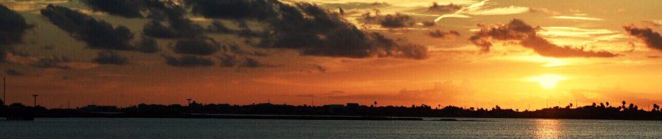
Like Edison, we arrived by boat and took an immediate liking to Fort Myers. The Municipal Yacht Basin was built as a public works project during the Great Depression, and is a shining example of a well run City marina. Though the facilities are a bit worn, the staff is competent and friendly. The ship’s store is stocked better than some West Marine’s, and priced better. Best of all, the marina is a short two blocks from a vibrant and charming downtown. The spot Edison picked for his winter home 135 years ago is just down the street.
We enjoyed the downtown immensely the first ten days of our stay. That first night, after our long cruising day, we had dinner at the Downtown Social House, and met Jim and Mary there, our friends on Pegasus. It was early March and CoronaVirus was still a Wuhon phenomenon. On the 8th, we met Dawn’s childhood friend, Bridgett Darnell, and went to see the local pro hockey team, the EverBlades (yes, what a great name). It was great fun, and though the team was playoff bound, it would be the last game they played before shutting down the season.
Young heroes, driftwood, seashells, and the Sanibel lighthouse
The following Monday, we went to the Edison-Ford Museum with Jim and Mary. The place was definitely worth the visit – in fact I want to go back. The following day, we drove to the beach on Sanibel Island, widely known for its fantastic shelling. Because parking at the beach is a gaudy $5.00/hr, we didn’t stay long. We then drove up island and stopped by the historical museum, a well-executed depiction of life on Sanibel before the bridge was built and word got out.
By that week, Coronavirus was killing a lot of Italians and Spain was thinking about another shot at Florida. Major League baseball cancelled spring training the next day, the week before our planned visit to Lakeland with Dawn’s brother Gary and their folks. We had a nice AirB&B reserved and great seats to see the Tiger’s play the Blue Jays, Yankees and Marlins.
Coronavirus was getting scarier, and social distancing had begun – out of fear not mandate. You may recall, Spring breakers were still infecting each other in Fort Lauderdale. We continued to enjoy downtown, testing our budget over oysters and mojitos at Izzy’s, burgers and beer at Ford’s Garage, crab and margarita’s at Pinchers, and Pizza at Capone’s. We were able to cancel our rental house in Lakeland, and Dawn’s parent’s cancelled their trip to Florida. Both the Tigers and our AirBnB host refunded us fully.
Happy siblings, good food, great beer, and mediocre music on the last open night in Fort Myers
Gary, still in need of a vacation, flew down to Tampa anyway, staying the week with us aboard Cirila. That first night, we ate dinner on the balcony at Patio 33, listening to live music played in the courtyard below. Business had already started to slow, so the bouncers let us on the rooftop lounge the Firestone Grill and Martini Lounge, despite our boaters attire – tee shirts, shorts and flip flops. The next evening, Bridgette joined us for BBQ at The Lodge, and afterwards, we walked the thinning streets, sipping road cocktails with folks trying to get in one last St. Patty’s week drunk. It was March 22 – Fort Myers closed up shop next day.
Cirila, the prettiest boat on H Dock at the Yacht Basin
We made the best of things the rest of our week with Gary, – eating well on board, listening to music and drinking beer all day. Reading the news was hard – the virus was spreading fast in the US, and we were not yet desensitized or hardened by it. Our friends John and Ruta Kalnins were in Florida and had planned to visit, but called a wise audible and drove home to Michigan instead. Gary also made travel adjustments, rebooking his flights on a nonstop from Tampa to Detroit in order to avoid potential exposure during an Atlanta lay-over.
The pilothouse converts to my painting studio in about 10 minutes. No lack of natural light!
Our plans to spend April in Marathon, down in the Keys, were dashed when the whole archipelago shut down for non-residents. Then, marina’s up and down the East and Gulf coast began to shut down to transient boaters. Tucked in our secure slip in a nice place, we extended our stay in Fort Myers. We’ve been hunkered down ever since. The few restaurants downtown that did offer take-out have since closed, so our galley has been a busy place. Because there is no urgency to anything but safe isolation, I’ve been more motivated to paint, read, and write than to work on boat projects. Dawn sewed masks for us, made more for our boating friends, and is working to replace that cushion that blew off the boat in New Orleans. Screen time on our devices is way up; the Apple Store seems to be the only economic beneficiary of our quarantine. The liquor store hasn’t done bad either! We count our blessings to be here, together, in our self-contained little world, unstressed by lost jobs or overwhelming bills. We pray for those not so lucky.