We decided to cross from the Gulf to Atlantic side of Florida via the Okeechobee Waterway instead of around the Florida Peninsula through the Keys. Time, expense, hurricane season, and depth factored into our decision. Now, in hindsight, it was a great call, because Hurricane Eta made landfall about ten miles from where we planned to stay.
The Waterway was a public works project during the depression. Many cool things for boaters came about during the depression. The TVA system is another example. Okeechobee is that big lake in the middle of Florida, and surprisingly, is the second largest freshwater lake in the contiguous US. A large dike named after Herbert Hoover surrounds it. To the West, the Caloosahatchee River and canal drain to the Gulf, while the Saint Lucie River and canal system drains water to the Atlantic. Since Lake Okeechobee is about 15′ above sea level, three locks and dams control water levels on the Caloosahatchee, while just two handle the drop on the St. Lucie side.
In the week before our planned departure, I changed the engine oil, raw water impeller, and pencil zinc in the heat exchanger. These were firsts for me, and first oil change since leaving Houston. It was easy work, but as usual, I was sore for a few days from crawling around in the engine room.

Slow boats like ours make this 135 mile trip in two or three days. We opted for two, with a planned overnight in the fishing haven of Clewiston, on the South side of Lake Okeechobee. As usual, my nerves jangled in the days before our departure, making me wonder what astronauts go through. Navigating the locks and crossing Okeechobee were my main concerns. Because it’s shallow, Okeechobee can get very rough in a blow and we were targeting a weekend weather window forecast to slam shut the Monday after our trip.
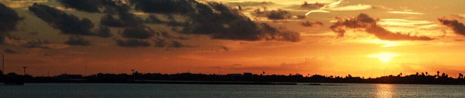
Leaving Fort Myers just after sunrise on Saturday, we turned upriver and into the heart of Florida. The river is wide until one passes under I-75, laden with RVs full of returning snowbirds. The first bridge, the Wilson Piggot, opened on command, barely slowing our inertia before arriving at the Franklin Lock. Its tender, Sonny, made it an easy and pleasant experience. From atop the lock wall, he chatted with us about the trip ahead. As it winds inland, the Caloosahatchee is bordered by small oxbows, most with docks and homes tucked behind mangroves and cypress lining the banks. Beyond the lift bridges marking the small towns of Alva and Labelle, we came to the Ortona Lock. Its tender was no Sonny, forcing us to guess where and which side of the lock to tie up to. We locked without issue, pressing East as the waterway evolves from river to canal. The fifteen miles to Moore Haven, on the West side of the lake, would have been boring if it were not for the exquisite rainbow we chased for over an hour. We tried to sail under it, but could never quite get there.

The municipal dock in Moore Haven was our fall back overnight spot, but locks and bridges went so smoothly that we had time to make Clewiston. We waited for a train of sugar can pulp to pass before squeezing through the narrow swing bridge and into the Moore Haven lock. Emerging on the opposite side, we turned right and into the waterway bounded by Hoover’s dike to starboard, and the marshy edges of Lake Okeechobee to port. There, we caught up with the rain causing that beautiful rainbow. For an hour it came down in buckets, our visibility marginal because the center wiper that failed us back on Lake Pontchartrain quit again. Thankfully, the channel was wide and boat traffic minimal. About 10 minutes from Clewiston, the storm passed and we cleared the small lock protecting Roland Martin marina on the opposite side.

Since staff was gone for the day, we picked a spot along the dock, tied up, and took an anxious Lola out for some relief. We ate and had a couple drinks at the Tiki Bar, a fairly famous stop along the way, judging by the number of tee shirts and other swag for sale. The ten hour day on the water zapped our energy so we called it an early night.
On the opposite side of Okeechobee is a lock called Port Mayaca. Our friends on Golden Daze (remember them from the crossing?) traversed it two days before, when it was on emergency generator power. It closed for the day soon after they locked through. After confirming that it was back up and running, we left Rowland Martin in early light, waited an hour behind a line of fishing boats to clear the lock, then made our way out the channel and into Lake Okeechobee.
Unlake northern lakes, Okeechobee doesn’t have a very definitive bank. We followed a marked channel through thickets that became wetlands that eventually became the lake. We chose the shorter route that zig-zags across the lake, seeing only one other boat during our four hour crossing. Conditions were ideal and on the final heading, our autopilot guided us through bands of neon blue green algae on our way to Port Mayaca. We locked through with Mark and Yvette Clark, (on that other boat) who were returning home to Stuart with a sailboat they just bought in Port Charlotte. Unfamiliar with its fuel system, their engine quit just as they entered the lock. I’m not sure why you’d buy a used sailboat when you circumnavigated twice on your old one. Maybe they just wore it out. We waited with them while Mark worked the fuel supply, got their engine back online, then steered out the St. Lucie canal, Eastbound.

Mile-long straightaways made for an uneventful, if not boring motor through the farmlands of central Florida. Nobody won our contest for who would spot the first alligator. Occasionally, small racing boats would zip by on either side, shooting up rooster tails, but leaving little wake. The scenery grew more compelling the further east we travelled, with waterfront homes slowly growing in size and gaudiness.
An hour past Indiantown, we approached the Saint Lucie Lock and Dam, holding station for about 15 minutes while the chamber filled. Along with 3 other boats, we dropped 13′ to the South fork of the Saint Lucie River below. Continuing East, we passed under I95, then The Florida Turnpike, more RVs southbound, and into the wider waters around Stuart. Awaiting the Roosevelt bridge opening, we idled 100 yards off Brian and Nataly’s yacht, FitNautic, resting in her slip at Sunset Marina. We were livaboard neighbors in Houston two years prior!

Under the bridges and around the corner, we made our way into slip B-57 at the Harborage Yacht Club and Marina. Some folks know it as Loggerhead Marina, but that was before Hurricane Irma destroyed it in 2017. Though the slip is a bit tight, the facilities are first class – for all except for Lola. Patches of grass are small, few, and far, but I suppose they are rich with smells. We got the collapsable wagon out to help ferry her to her dumping grounds.
The day after we arrived, winds picked up as forecast. Winds started at 15-20 that Monday, and by the weekend, with Hurricane Eta churning off the Florida Keys, they got downright nasty. Weary of a week of rocking, we spent last night at Eamer’s house as the worst of the storm came through. Cirila made it through the night with a couple bumps and bruises, but nothing major. A few other boats were not so lucky. Now, the winds continue to settle, and we look forward to a calmer week so we can tend to some boat chores and plot our next move.
Still enjoying your adventures!!