Over the past few months, I’ve flown to Cleveland just about every way Southwest Airlines can get there from Houston. I’ve connected in St. Louis, New Orleans, Nashville, Chicago, Baltimore and Atlanta. Add flights to Ft. Lauderdale in May and Detroit last week, and you’ll see that I’ve flown over about 80% of the Loop route these past three months.
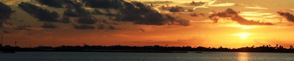
I’m a window seat guy who rarely draws the shade. Maybe that’s because I’ve always been a map guy, which I got from my dad. I love looking out the window, trying to track where we are by the topography, roads, and waterways. I’m awed by the landscape, the sprawl of cities, the expanse of forests and farmland, the beauty and remoteness of rural America. As our Great Loop Adventure draws nearer, now just two months away, I’m especially amazed at the distance we will cover.
The flights have taken me over many of the waters we will cruise, from our first day out the Houston ship channel before turning east into the Intercoastal Waterway towards Louisiana, to our final leg south down the Tom Bigbee Waterway before closing our Loop, or “crossing our wake”, near Mobile. The stretch between Houston and New Orleans is laden with industrial traffic; barge-spotting is about the only way to track the Intercoastal meandering through the channels and swamps of the Atchafalaya basin.

The Mississippi River above New Orleans
Flying into New Orleans, I made mental notes of the Harvey and Industrial Canal locks, and the short jump across the Mississipi that flows between them. My imagination had spawned fear of this stretch – of crowded, dangerous locks, rampant commercial traffic fighting the tortuous current of the lower Mississippi, boats going in all directions like carnival bumper cars. From above, it looked far less intimidating and less crowded than the picture painted by my imagination.
Its easy to get excited about boating when flying over the west coast of Florida. The Intercoastal between Clearwater and Marco Island to the south is easy to see from above – azure waters and white sand beaches surrounded by million dollar homes, high rise condos, and golf courses. While that might not sound too scenic, we rented a small boat while vacationing in Indian Rocks Beach a couple years ago – it was great. I look forward to that part of the loop in our own mobile vacation home, able to dock or drop anchor wherever we wish to explore.
I like flying into Baltimore because it offers beautiful views of that part of our Loop. We plan to spend much of the summer of 2020 in the Chesapeake Bay, exploring and visiting Washington for cherry blossoms, and Solomon’s Island where our crazy boat dream hatched at Trawler Fest a decade ago. That flight offered a nice view of Annapolis and of Baltimore’s inner harbor, both on our itinerary.
Flying into Cleveland, Detroit, and Chicago all offer great views of the Lake Erie and Lake Michigan, even though only the latter is on our Loop 1 itinerary. That’s because our planned route ventures across Lake Ontario and north through Ontario into Lake Huron’s Georgian Bay, skipping Lake Erie entirely. On flights into Detroit, I enjoy picking out Lake St Clair, Toledo, and Put-in-Bay on Lake Erie, hoping we visit on a second Loop. On one clear flight between Chicago and Cleveland, I could see southern Lake Huron, many miles north at Port Huron/Sarnia. And of course, climbing in and out of Chicago is always a thrill, both for its beautiful skyline and the blue waters of Lake Michigan – I can’t wait to see it from our boat!
Traveling through St. Louis, I’ve seen nearby Peoria from the air; I’ve also seen it from a steel mill’s vantage point – neither thrilled me (Sorry Peoria). In May, spring floodwaters on the Mississippi were just beginning to recede, and I was awestruck to see how many places the floodwaters extended miles from the river, only rooftops visible. Seeing the St. Louis arch from above is awesome, and yes, it will be cool to visit, but I’m not so eager for this whole stretch down the Mississippi. Perhaps while cruising in the Great Lakes, before taking on this stretch, I should read some Mark Twain to get in the proper mood.
It’s always fun to see the Ohio River. I marvel at the chemical industry and power plants lining its banks, places I visited often early in my career, before I saw them as carbon villains. I always look for it, but our flight plans don’t take us over Paducah, Ky, where we’ll peal off southbound up the Tennessee River.
The landscape going in and out of Nashville is beautiful, with both Kentucky’s and Tennessee’s lake systems clear to see, and which should be even more beautiful from the water and during peak fall colors. There are so many lakes in view that it’s tough to pick out the ones which interconnect to make up the loop route – my theory is that they’re the ones with the biggest boats. Between Nashville and New Orleans, it was fun spotting the locks we’ll traverse on the Tom Bigbee. They’re much smaller than those near New Orleans since they needn’t accomodate the barge tows common on the gulf coast and I’m surprised by how close together many of them are. I’m sure that’ll be the dominant story on the Erie Canal and Trent Severn Waterway, but those are about the only two stretches of Loop I haven’t flown over recently.
As I wrote this we were actually flying over the Ohio River, just east of Louisville, on our way south to Nashville. Out the window at 35,000 feet, I’m amazed at the diversity and expanse of country we’ll see from the vantage point of it’s waterways. From high above, interstate traffic is crawling and boat traffic is practically still. How do you cover 6000 miles in a year when you’re barely moving?
With shades open and two months to go……